DDiscover AloneMapAbout

Jamestown

Historic town
Computer-made picture that does not show JamestownNot a photo of this monument
Computer-made picture. It does not show this monument. · Report the wrong picture

What is recorded here

Located in a low-lying position on the W bank of a S-N portion of the River Shannon, and close to a fording point of that river. Although a church called Cill Srianain or Cill Trenain was probably at this location in 1310, the town of Jamestown was established when it was incorporated by charter in 1622. The walls…

Read the whole record
Located in a low-lying position on the W bank of a S-N portion of the River Shannon, and close to a fording point of that river. Although a church called Cill Srianain or Cill Trenain was probably at this location in 1310, the town of Jamestown was established when it was incorporated by charter in 1622. The walls were built by Sir Charles Coote to a specification which required a rectangular circuit of 160 perches around the main street, two main gateways, a postern gate, and four corner-bastions (dims c. 370m N-S; c. 150m E-W) (Kerrigan 1980-81; 1995, 79). A government report of 1622-3 stated that ‘a range of 6 or 7 English houses of lime and stone’ had already been built and more were under construction. Coote erected a wooden bridge (LE031-082007-) south of the town which was still extant in 1683 (Logan 1971, 327) but this was replaced with a stone bridge by 1730. The town was besieged, but not captured, by rebels in 1641-2 (Mac an Ghalloglaigh 1965, 448-50), but a Franciscan house was established in the district probably after 1645 (MacNamee 1954, 231), and a meeting of Catholic prelates was held at Jamestown in 1650 (Mooney 1946, 5-8) after it had fallen to Catholic Confederate forces in 1648 (Kelly 2019, 207). The Down Survey barony map (1656-8) depicts the rectangular walled town with houses extending on either side of the road N to Carrick-on-Shannon, and also a second bridge from N of the town to Charlestown, Co. Roscommon. This bridge was never built and the map is merely a projection as it was intended to found a county town for Co. Roscommon at Charlestown across the river which never came to fruition (Bradley and Dunne 1988, 20). Jamestown had a population of 238 c. 1659 (Pender 1939, 559). The town was captured for King William by Col. Lloyd in 1689, and retaken by Patrick Sarsfield in the same year as it was an important crossing point of the River Shannon (Wauchope 1992, 78-81). The extent of the town can be gauged from the plots depicted on the 1835 edition of the OS 6-inch map, and the remains of the town wall. It was a rectangular enclosed area (dims c. 275m N-S; c. 110m E-W) with a single N-S street. The surviving remains consist of the North Gate (LE031-082001-), two sections of town wall (LE031-082002-), the church (LE031-082004-) and a star-shaped fort (LE031-082005-) which overlooks the town from a drumlin to the W. The site of the Franciscan house (LE031-082006-) is also within the walls, although its location is less certain. Archaeological testing has so far failed to recover features associated with the early occupation of the town, although the base of the town wall on the west side has been found through excavation (01E1191) in at least one place (Ryan 2002). Archaeological testing (E002895) during 2007 along the main street provided evidence of earlier cobbled surfaces (D 0.35m) overlying an organic layer with fragments of pottery , glass, oyster shells and bricks, flecks of charcoal and bone, dating to the seventeenth and eighteenth centuries. There was a cobbled road surface and drain at the S end (Delaney 2010). (Butler 1935; Loeber 1982-3; Logan 1971; Bradley and Dunne 1988, 19-31) See the attached image from the Down Survey map (N at left), which is reproduced courtesy of the National Library of Ireland (Ms 717).

From the National Monuments Service (Archaeological Survey of Ireland) record LE031-082

The monument record does not grant public access. Check the route and ask the landowner before entering private land.

What do you know about this place?Tap to add a comment or ask a question

What you write will be public.

Places near here

Photo credits
  • National Inventory of Architectural Heritage
  • Mike Searle, Geograph · Creative Commons Attribution-ShareAlike 2.0
  • Maker not stated on source page, www.pinterest.com
  • Maker not stated on source page, tr.pinterest.com
  • Maker not stated on source page, en.wikipedia.org
  • Pauline Leverett, Geograph · CC BY-SA 2.0
  • Brian Shaw, Geograph · CC BY-SA 2.0
  • Maker not stated on source page, commons.wikimedia.org
  • Maker not stated on source page, www.tripadvisor.com.ph
  • Maker not stated on source page, www.findagrave.com
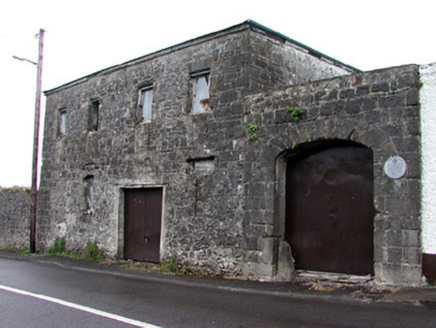
store/warehouse166 yd

Explorer Tom Store or warehouse in Jamestown used to house the overflow from the workhouse and now acts like it runs a very strict…
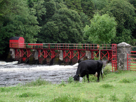
sluice/sluice gate255 yd

Explorer Tom Sluice or sluice gate in Jamestown controls the Shannon like it’s running a very serious Victorian traffic cop…

Jamestown HouseGate lodge · 362 yd

Explorer Tom Jamestown House gate lodge in Jamestown is hexagonal, like a giant stone honeycomb that lost its bees and most of its…

Fairy fort / earthen ringfort in JamestownFairy fort / earthen ringfort · 444 yd

Explorer Tom Fairy fort / earthen ringfort in Jamestown would be the guest at a wedding who stands by the buffet and eats all the…

Fairy fort / earthen ringfort in Tully (leitrim By., Carrick-On-Shannon Ed)Fairy fort / earthen ringfort · 519 yd

Explorer Tom This Tully ringfort has strong opinions about the road leading to it, thinking it’s too slow and noisy. It sits by the…

Bridge in JamestownBridge · 522 yd

Explorer Tom Bridge in Jamestown has an imaginary twin across the sea that refuses to shake hands because it’s too busy being…

Fairy fort / earthen ringfort in RueFairy fort / earthen ringfort · 1042 yd

Explorer Tom Fairy fort in Rue had the most dramatic event: a goat got stuck on the bank. It bleated for an hour while everyone…

bridge1323 yd

Explorer Tom Bridge in Drumsna is having a massive argument with the nearest tree about who looks better from the river. It’s got…

Shannon LodgeHouse · 1389 yd

Explorer Tom Shannon Lodge in Drumsna is still waiting for the N4 traffic to come back so it can feel important. It’s got carved…

Old GraveyardVisitor information · 1515 yd

Explorer Tom The Old Graveyard here is where the builders really panicked about the weather and decided to park their tools…

Old Annaduff Parish GraveyardCemetery · 1570 yd

Explorer Tom The one thing Old Annaduff Parish Graveyard is proud of is that it has never once let a single weed grow out of place…

Mapped graveyardGraveyard · 1628 yd

Explorer Tom Mapped graveyard in County Leitrim is home to a legend about a giant who got stuck trying to get out. He eventually…

More archaeology and monuments in County Leitrim · All of County Leitrim

Add to this placeAdd a picture Add a detailed tip Add a story

Explore the map1,095,414 places to discover

Next place · or swipestore/warehouse