What is recorded here
The town was completely defended by a town wall which had bastions at the four corners and two demi-bastions at the centre of the long E and W walls, as recorded on a map of 1730 by Thomas Moland. A length of town wall survives at the N end of the W side of the town (L 20m; ext. H 1.8-3m) but no distinguishing features are evident. A section of the town wall (L 7m; H 3m; T 1.2m) also survives at the S end of the W side of the town, which has no visible distinguishing features. The line of the wall can be traced as a break in slope to its N (L 23m) and S (L 18m). The North Gate of Jamestown (LE031-082001-) was destroyed by Patrick Sarsfield in 1689 when he retook the town from Col. Lloyd, but it was rebuilt c. 1780 by Hugh O'Beirne. Its arch was taken down after it was damaged in 1973. Two in-turned piers survive, creating a passageway (Wth 4.3-5.3m; L 2.8m), together with adjacent parts of the town wall. The base of the town wall on the W side has been found through excavation (01E1191) in at least one place (Ryan 2002, 2003). (Bradley and Dunne 1988, 23-6)
The above description is derived from 'The Archaeological Inventory of County Leitrim' compiled by Michael J. Moore (Dublin: Stationery Office, 2003).
The town was completely defended by a town wall which had bastions at the four corners and two demi-bastions at the centre of the long E and W walls, as recorded on a map of 1730 by Thomas Moland. A length of town wall survives at the N end of the W side of the town (L 20m; ext. H 1.8-3m) but no distinguishing features are evident. A section of the town wall (L 7m; H 3m; T 1.2m) also survives at the S end of the…
From the National Monuments Service (Archaeological Survey of Ireland) record LE031-082002
This remains an important historical record, but the official description says the monument is no longer visible or has been destroyed. The monument record does not grant public access. Check the route and ask the landowner before entering private land.
- What survives
- No visible remains or recorded as destroyed
Places near here
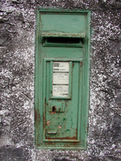 post box73 yd
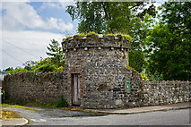 Jamestown HouseFolly · 75 ydEnclosure in JamestownEnclosure · 470 ydIndicatedFairy fort / earthen ringfort · 717 ydPatrick Gill Memorial Plaque (ira)Monument · 1481 ydRobert Strawbridge MemorialMemorial · 1587 ydWildlife AreaNature reserve · 1.0 miSite of Dangan CastleCastle, unclassified · 2.3 miMoon RiverHeritage attraction · 2.8 miMullinashee WoodForest · 4.3 miInishmoylinIslet · 4.3 mi
 Cavan & Leitrim RailwayMuseum · 6.5 mi
Pictures: National Inventory of Architectural Heritage; Mike Searle, Geograph · CC BY-SA 2.0; Reading Tom, Wikimedia Commons · CC BY 2.0
More archaeology and monuments in County Leitrim · All of County Leitrim
What do you know about this place?