What is recorded here
Located on a gentle S-facing slope with the SW-NE River Shannon c. 150m to the S. It was first identified by S. Curran as part of an M.A. Thesis with University College Dublin using a LiDAR survey dataset commissioned by Leitrim County Council and the NRA. This is a D-shaped grass-covered area (dims 58.6m N-S; c. 58m E-W) defined by an earthen bank (at N: Wth 5.1m; int. H 0.1m; ext. H 0.5m) and outer fosse (at N: Wth of top 7m; Wth of base 2.5m; D 0.1m) NW-NNE and a scarp (H 0.3m SE-SSW, but the perimeter is barely traceable SSW-NW. It is curtailed by a NNW-SSE field bank (L 62m) at E. A NW-SE field bank that is marked on the 1835 ed. of the OS 6-inch map has been removed in the past leaving a scar, and the perimeter is not realy traceable W of this feature. There is no identifiable entrance. The bank is not very defensible, and it is possible that the enclosure was a tree-ring.
Located on a gentle S-facing slope with the SW-NE River Shannon c. 150m to the S. It was first identified by S. Curran as part of an M.A. Thesis with University College Dublin using a LiDAR survey dataset commissioned by Leitrim County Council and the NRA. This is a D-shaped grass-covered area (dims 58.6m N-S; c. 58m E-W) defined by an earthen bank (at N: Wth 5.1m; int. H 0.1m; ext. H 0.5m) and outer fosse (at N:…
From the National Monuments Service (Archaeological Survey of Ireland) record LE031-109
This remains an important historical record, but the official description says the monument is no longer visible or has been destroyed. The monument record does not grant public access. Check the route and ask the landowner before entering private land.
- What survives
- No visible remains or recorded as destroyed
Places near here
Photo credits
- Mike Searle, Geograph · Creative Commons Attribution-ShareAlike 2.0
- National Inventory of Architectural Heritage
- Reading Tom, Wikimedia Commons · CC BY 2.0
 Jamestown HouseGate lodge · 307 yd
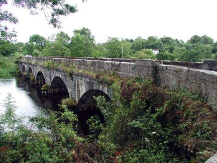 Jamestown BridgeBridge · 319 ydIndicatedTown defences · 470 ydIndicatedFairy fort / earthen ringfort · 967 ydPatrick Gill Memorial Plaque (ira)Monument · 1.0 miRobert Strawbridge MemorialMemorial · 1.1 miWildlife AreaNature reserve · 1.1 miSite of Dangan CastleCastle, unclassified · 2.1 miMoon RiverHeritage attraction · 2.8 miMullinashee WoodForest · 4.0 miInishmoylinIslet · 4.2 mi
 Cavan & Leitrim RailwayMuseum · 6.5 mi
More archaeology and monuments in County Leitrim · All of County Leitrim
What do you know about this place?