
What is recorded here
From the National Monuments Service (Archaeological Survey of Ireland) record CO110-064
Places near here
Photo credits
- National Inventory of Architectural Heritage
- Neville Goodman, Geograph · Creative Commons Attribution-ShareAlike 2.0
- Hywel Williams, Geograph · CC BY-SA 2.0
- Mac McCarron, Geograph · CC BY-SA 2.0
- Wikipedian231, Wikimedia Commons · CC0
 TullylandFarm house · 89 yd
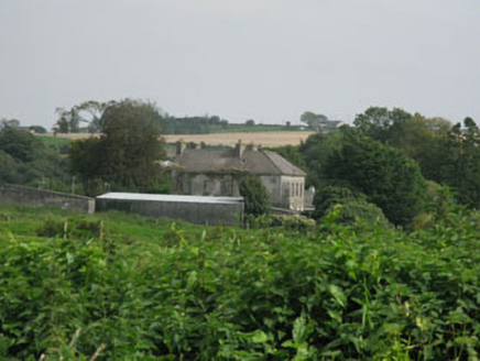
Explorer Tom Tullyland in Tullyland is keeping its historic fabric safe with timber sliding sash windows that probably squeak every time the wind blows. Have a look around those rubble stone outbuildings, they seem to have it all figured out.
 BrookfieldHouse · 1712 yd
Explorer Tom Brookfield in Tullyland is showing off its slate hanging and timber sliding sash windows like it's trying to impress you. Built around seventeen-eighty and extended later, it's got a U-plan that's actually quite interesting. Give those rear returns a good look for me!
Graveyard (Disused)Burial ground · 1.2 miExplorer Tom Graveyard (Disused) in Rathdrought is now used as a dump, so the ghosts are probably too lazy to haunt it because they're too busy moving boxes. Go on, count the windows and get it wrong like I did.
Carbury's WellSpring · 1.5 miMarie LouiseWreck · 2.2 miBandon War MemorialMemorial · 2.3 mi Kilpadder Burial Ground (Site of)Burial ground · 2.4 mi
Explorer Tom Kilpadder Burial Ground is hiding in the pasture so deep it refuses to fall down or get found. The overgrowth is basically doing a great job of keeping secrets. Bring a jacket, it's never as warm as I promise.
Carrighnassig Castle (Site of)Castle, unclassified · 2.4 miExplorer Tom Carrighnassig Castle sits on a river bend where MacCarthy Riabhach probably got stuck in traffic. It’s right next to another tower house that seems jealous of its spot. Perfect place to be dramatically windswept and complain about your knees.
Cathal Hurley MemorialMemorial · 2.5 mi Trinity WellSpring · 4.7 mi
 Garranefeen StrandBeach / strand · 4.9 mi
 The Moving StatueHeritage attraction · 5.6 mi
More archaeology and monuments in County Cork · All of County Cork

What do you know about this place?Tap to add a comment or ask a question