What is recorded here
From the National Monuments Service (Archaeological Survey of Ireland) record KE060-050
Places near here
Photo credits
- Maker not stated on source page, commons.wikimedia.org
- Maker not stated on source page, www.dreamstime.com
- Gneeveguilla GAA Club / photographer not named, www.gneeveguillagaa.ie
- Maker not stated on source page, za.pinterest.com
- Maker not stated on source page, www.pinterest.com
- Maker not stated on source page, www.gpsmycity.com
- Adrian King, Geograph · CC BY-SA 2.0
- Maker not stated on source page, nl.pinterest.com
- National Inventory of Architectural Heritage
- Maker not stated on source page, animalia-life.club
- Maker not stated on source page, uk.pinterest.com
 Fairy fort / earthen ringfort in MausrowerFairy fort / earthen ringfort · 1057 yd
Explorer Tom Fairy fort / earthen ringfort in Mausrower is just a faint cropmark now, sadly. It’d order chips and gravy, then regret…
 Standing stone in TooreennamultStanding stone · 1223 yd
Explorer Tom Standing stone in Tooreennamult used to be part of a duo, but its partner vanished like my keys. Now it stands alone…
 Gneeveguilla GAA pitchGAA ground · 1.1 mi
 Fairy fort / earthen ringfort in BawnardFairy fort / earthen ringfort · 1.9 mi
Explorer Tom Fairy fort / earthen ringfort in Bawnard bragged it survived a storm that broke every other wall in the county. It’s…
 Fairy fort / earthen ringfort in LisheenFairy fort / earthen ringfort · 2.0 mi
Explorer Tom Fairy fort / earthen ringfort in Lisheen claims its favorite song is 'Levelled and Tilled' because that’s what happened…
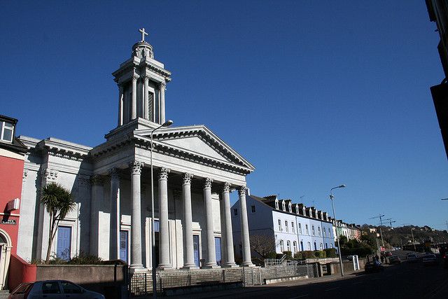 Catholic ChurchChurch · 3.7 mi
Explorer Tom Catholic Church in Farrankeal sits right next to the fair green, so it's probably seen some wild characters over the…
 Knocknagree Roman Catholic ChurchChurch/chapel · 3.7 mi
Explorer Tom Knocknagree Roman Catholic Church is having a quiet rivalry with every other church in town. It’s got Gothic lancets…
 Standing stone in Park (duhallow By., Nohavaldaly Par.)Standing stone · 3.7 mi
Explorer Tom Standing stone in Park, County Cork used to be part of a pair called 'dallans', but both were removed in the late 1970s…
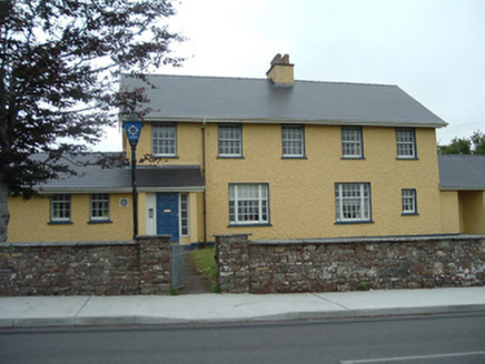 Knocknagree Garda StationGarda station/constabulary barracks · 3.8 mi
Explorer Tom 17. Knocknagree Garda Station looks like a fancy country house because it was built in the Domestic Revival style…
 Nohoval BridgeBridge · 4.3 mi
Explorer Tom Nohoval Bridge is solid rubble with cut-stone voussoirs that probably cost a fortune back in the day. It’s a testament…
 Church (Site of)Church · 4.3 mi
Explorer Tom Church in Nohaval Lower is hidden in a graveyard. The 1842 map showed ruins, but now there’s no trace at all. Just dirt…
 Stone row in Ummeraboy WestStone row · 4.8 mi
Explorer Tom Stone row in Ummeraboy West, County Cork used to be three stones in a line, but they’ve all been removed now. Bowman…
More historic places in County Kerry · All of County Kerry

What do you know about this place?Tap to add a comment or ask a question