
Places near here
Photo credits
- National Inventory of Architectural Heritage
- Mike Searle, Geograph · CC BY-SA 2.0
- N Chadwick, Geograph · Creative Commons Attribution-ShareAlike 2.0
- Sitomon, Wikimedia Commons · CC BY-SA 2.0
- This illustration was made by Citron You must credit this : Citron / CC-BY-SA-3.0, Wikimedia Commons · CC BY-SA 3.0
- Hywel Williams, Geograph · CC BY-SA 2.0
- Jonathan Billinger, Geograph · CC BY-SA 2.0
Explorer Tom Embanked enclosure in Ballyhamlet has strong opinions about that road leading to it, which is basically nowhere. It’s barely visible, just a grassy circle pretending to be important on a spur between streams. Pretend you're a lost aristocrat, nobody will check.
 Kilmore HouseGate lodge · 1269 yd
Explorer Tom Kilmore House gate lodge in Kilmore East is proud of its high-pitched roof, which it thinks looks very aristocratic. It was built by a Brigadier-General who clearly had a thing for angles. Count your steps carefully as you admire its compact, breakfronted elegance.
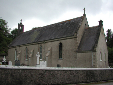 Catholic Church of the Holy CrossChurch/chapel · 1.1 mi
Explorer Tom Catholic Church of the Holy Cross (Churchquarter) would post on social media: 'Just another day in the cruciform life 🙏 #HistoricArchitecture #ThomasScully #1920sVibes' with a filter on its spire. It repurposes an early 19th-century chapel, so it’s basically a renovation project that never really stopped evolving over the decades. Like the post if you can see the com
 Glennawillin SchoolSchool · 1.2 mi
Explorer Tom Glennawillin School was so hidden in the hills that Vikings would have sailed right past it looking for treasure and ended up finding a classroom full of chalk dust instead. It’s one of the earliest purpose-built schools around, which means it has more stories than I do after three pints of stout. Listen for echoes from the windows.
Tallow HillMountain / peak · 2.3 miExplorer Tom Tallow Hill was once offered by a cow who thought she owned the deed because she had grazed there for forty years. The solicitor accepted, and now the hill has a weirdly bovine energy that you can feel in the wind. Get a photo with it before it gets a better agent.
 Lisfinny CastleCastle · 2.5 mi
Explorer Tom Lisfinny Castle makes a dreadful wheezing sound at night that locals swear is just wind, but I bet it’s actually the ghosts stretching their legs after a long nap in the tower. It’s been sitting above the Bride River looking smug since Raleigh’s day. Leave nothing but footprints and a bad pun.
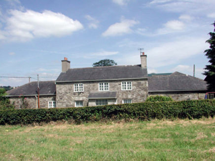 Lismore CastleFarm house · 4.4 mi
Explorer Tom Lismore Castle’s farmhouse would use its lotto win to install a very discreet dovecote that actually sings opera. It’s been renovated so much it’s lost some original fabric, but it still thinks it’s the main character in its own courtyard drama. Just watch the pigeons, they're plotting.
 St. Carthaghs WellHoly well · 4.4 mi
Explorer Tom St. Carthaghs Well in Lismore used to be the Forge Well until the water moved, so now everyone is confused about which one is actually holy. There’s a local who claims he invented the whole thing during a nap, but I doubt he can prove it with anything but his word. Look serious, nod slowly, you're basically an expert now.
 European Yew4.4 mi
Explorer Tom European Yew in County Waterford is where a priest lost a bet and never quite recovered his dignity afterwards. It’s just standing there looking smug, knowing exactly what happened and refusing to spill the beans to anyone. Bring a flask of something warm and a story to swap.
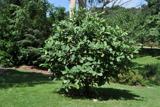 Delavay's magnolia4.5 mi
Explorer Tom Delavay's magnolia in County Waterford looks like it was bought at a very expensive auction by a cow with excellent taste. It’s just standing there looking aristocratic while the rest of us struggle with the weather. Snap one photo, then put the phone away and actually look.
 Ballysaggartmore TowersVisitor information · 4.7 mi
Explorer Tom Ballysaggartmore Towers in County Waterford hosted a dramatic incident where a goat stole the keys to the gatehouse. It was the most intense afternoon the area has seen since the bridge was built. Take a mate and argue about what it was for.
 Sheanmore Castle (in ruins)Castle, tower house · 5.0 mi
Explorer Tom Sheanmore Castle had a poet fall into the ditch nearby who wrote a very bad poem about the mud and his dignity. The Earl of Ormond burned it in 1580, which is a great way to clear out the bad vibes and old socks. Best seen with a hangover and a sausage roll.
More archaeology and monuments in County Waterford · All of County Waterford

What do you know about this place?Tap to add a comment or ask a question