Places near here
Photo credits
- Antony Dixon, Geograph · CC BY-SA 2.0
- National Inventory of Architectural Heritage
- Antony Dixon, Wikimedia Commons · CC BY-SA 2.0
- Sarah777, Wikimedia Commons · Public domain
- Garry Dickinson, Geograph · CC BY-SA 2.0
- Andreas F. Borchert, Wikimedia Commons · CC BY-SA 4.0
- P L Chadwick, Geograph · CC BY-SA 2.0
- Oliver Dixon, Geograph · Creative Commons Attribution-ShareAlike 2.0
- Discover Lough Derg, Wikimedia Commons · CC BY-SA 2.0
Explorer Tom Site of Derryleigh Castle in Derryleigh has an imaginary fan club that meets every Tuesday to mourn its total disappearance from sight. They don't know what they're mourning, but they show up with flags and enthusiasm anyway. Sit on a wall near it and pretend you're in a painting.
 Clare BridgeBridge · 1.6 mi
Explorer Tom Clare Bridge in Rossary More is having a dramatic standoff with the nearest tree over who gets more sunlight. Its arch is irregular in a way that suggests the builder had a bit of a moment mid-construction. Enjoy the wooded view without trying to touch the masonry!
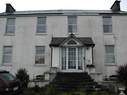 ClareviewCharter school · 2.0 mi
Explorer Tom Clareview looks like it would be the uncle at a wedding who brings his own chair and sits down without being invited. It used to be a school, then a barracks, so it’s seen some stuff. Keep your eyes open
Slieve Felim WayWalking route · 2.5 miExplorer Tom Slieve Felim Way had its most dramatic moment when a sheep looked at it with pure disdain, which was honestly more shocking than any landslide. The trail is just a path that's too busy being scenic to notice your blisters. Go back in winter, it's a different animal.
 Slieve FelimMountain / peak · 2.8 mi
Explorer Tom Slieve Felim sounds like it was named for a fellow called Felim, and I was nearly ready to invent his long beard. The older Irish name points instead to Ébliu, an ancient goddess. Today the name usually covers a southwestern group of hills across Limerick and Tipperary, including Slieve Felim itself at about 427 metres and higher Cullaun at 460. Earlier writers used it for a much broader mountain area. There is also a marked Slieve Felim Way for walkers. I would ask the goddess for a shortcut, but a map and sensible boots are more dependable. Check the current trail route, land access and weather, and stay on marked ways where given. Look across the rolling ridges before choosing which hill is which. Even the name has wandered farther than most visitors.
Sliev Felim WayVisitor information · 3.6 miExplorer Tom Sliev Felim Way has a bad poem carved into a rock that rhymes 'way' with 'day', which is frankly embarrassing for everyone involved. I spent twenty minutes trying to make it sound like a limerick and failed miserably. Tell it a joke, because it's been a long time since anyone did.
 Keeper HillMountain / peak · 5.7 mi
Explorer Tom Keeper Hill sounds like a mountain that would mind my coat while I wandered off, but it asks you to mind your own footing. At 694 metres it tops Tipperary's Silvermine Mountains. Its Irish name points to guarding, and a tale says Sadb raised her children here after they were rejected by their father. That is a story, not an archaeological label for every stone. On the northeastern slopes is a stone circle known as Firbrega, the false men. I would introduce myself to them and be outnumbered at once. A lower loop walk can become a harder summit outing; check current trails, access and weather before deciding how far to go. Stay clear of protected stonework and soft upland ground. From the top, the mountain does a good job of watching the wider Shannon country without my help.
 CastleCastle, motte and bailey · 6.6 mi
Explorer Tom The motte at Brittas is losing a rivalry with a more famous place because it got levelled by a farmer. Sit on a wall near it and pretend you're in a painting; nobody will mind if you drop your hat.
 Cath.Cathedral · 8.2 mi
Explorer Tom Cathedral in Shantraud is hiding its light under a very large bushel of mystery. The locals probably think the roof leaks because they forgot to pay the celestial plumber. It’s a proper spot for a flask of tea and a big, confused think about history.
 Brian Boru Heritage CentreVisitor information · 8.3 mi
Explorer Tom Brian Boru Heritage Centre in County Clare is hiding a treasure chest inside the library that definitely contains nothing but stale biscuits and old newspapers. The lock-keeper’s ghost is still guarding it for no reason. Ten minutes here and you'll have a yarn for the pub.
 TobermurraghHoly well · 8.6 mi
Explorer Tom Tobermurragh in Knockyclovaun was once taken over by a fox who demanded tribute in exchange for guarding the water supply. The red brick enclosure stands as a monument to that brief but chaotic reign of canine authority and questionable judgment. Linger, it's not going anywhere and neither should you, really.
.jpg/250px-Brian_Boru's_Fort_(51357382309).jpg "Photo: Discover Lough Derg, Wikimedia Commons · CC BY-SA 2.0") Brian Boru FortHeritage attraction · 9.2 mi
Brian Boru FortHeritage attraction · 9.2 miExplorer Tom Brian Boru's Fort is a grand name, and I would be the first to announce the king built every bank by hand. Archaeology asks for more care. Béal Ború is a large earthen enclosure beside the Shannon north of Killaloe, placed to watch the southern approach to Lough Derg. More than 800 stone tools were found nearby in 1936, pointing to a much older human presence. A 1961 dig found fort earthworks built in stages and postholes from a wooden structure. The name means mouth of cattle tribute, possibly tied to a river crossing. Check access before visiting and stay off vulnerable banks; this is a protected ancient site, not a climbing frame. Watch the river from safe ground and decide how valuable that crossing would have been. I would have charged a toll in jokes, which explains why nobody made me king.
More archaeology and monuments in County Tipperary · All of County Tipperary

What do you know about this place?Tap to add a comment or ask a question