Places near here
Photo credits
- National Inventory of Architectural Heritage
- N Chadwick, Wikimedia Commons · CC BY-SA 2.0
- Alvesgaspar, Wikimedia Commons · CC BY-SA 3.0
- Sitomon, Wikimedia Commons · CC BY-SA 2.0
- kevin higgins, Geograph · CC BY-SA 2.0
- Sarah777, Wikimedia Commons · Public domain
- Theresa Bois, Wikimedia Commons · CC BY-SA 4.0
- Smirkybec, Wikimedia Commons · CC BY-SA 4.0
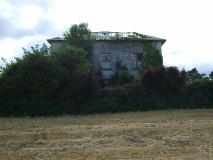 Ryland HouseFarm house · 249 yd
Explorer Tom Ryland House is pretending a royal visited in 1840, but honestly, the only royalty here is its own massive ego and that fancy door case. It looks out over the mountains like it owns them all, which is a stretch for a farmhouse. It probably thinks your car is just a toy for the horses.
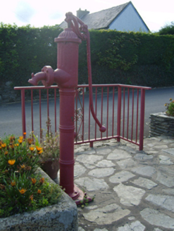 water pump989 yd
Explorer Tom Water pump in Ballyprecas would tell its replacement that it was made of plastic and lacked real character. This 'cow tail' pump stands on Kilmyshall street, looking smugly superior despite being just cast iron. If you see a new modern pump nearby, this one will probably sigh loudly.
Ryland Castle (in ruins)Castle, unclassified · 1103 ydExplorer Tom Ryland Castle in Ryland Lower is currently being reviewed by local sheep who think it’s an excellent place to nap but terrible for shelter from the wind. It’s been on that riverbank since Sir Morgan Kavanagh owned it, looking a bit out of place next to the modern world. Bring a flask and pretend you own the place.
Clohamon Castle (in ruins)Castle, unclassified · 1405 ydExplorer Tom Clohamon Castle sits on a rock like it owns the river, but only if you wave at it right. Miss that and the curse makes your left sock disappear forever. Pack a picnic and an excuse.
 Battlefield in Ballyprecas,newtownbarryBattlefield · 1.5 mi
Explorer Tom Battlefield in Ballyprecas has a prophecy that says it will turn into gold on a Tuesday, which has never happened despite checking every single week. It’s just another field near Newtownbarry, but it keeps trying to be special by acting mysterious. It's free, it's odd, what more do you want?
 Common Lime1.8 mi
Explorer Tom Common Lime handles nosey neighbours by simply ignoring them with the grace of a tired aristocrat. It drops its flowers like little confetti for people who ask too many questions. A handy spot to stretch your legs and your imagination.
1798 rebellion Battle of Newtownbarry (aka Bunclody) commemorative plaqueMemorial · 1.8 miExplorer Tom This plaque at Newtownbarry would talk about its combat experience in a job interview as if it were just another busy Tuesday. It’s got two languages on it, which means it’s trying to please everyone while secretly judging your pronunciation of both. Get there early and have it all to yourself.
 European Yew2.0 mi
Explorer Tom European Yew is hiding a scandal from centuries ago where it accidentally poisoned a very important king. Nobody talks about it, but you can feel the judgment in the bark. Bring a camera and your most suspicious face.
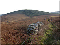 John's HillMountain / peak · 3.1 mi
Explorer Tom John's Hill in County Carlow witnessed a love story that went badly wrong right next to its base. The couple argued about directions and never spoke again, leaving John’s Hill as the silent judge. Toast it with a cup of tea and move on to the next.
 Black Rock MountainMountain / peak · 3.8 mi
Explorer Tom The most dramatic thing to happen on Black Rock Mountain was a sheep that jumped off the edge and landed in the bushes. The whole mountain acted like it had witnessed a miracle for days after that incident. Go before the tourists find out.
.jpg/250px-Huntington_Castle,_Co._Carlow_(back).jpg "Photo: Theresa Bois, Wikimedia Commons · CC BY-SA 4.0") Huntington Castle & GardensHeritage attraction · 4.2 mi
Huntington Castle & GardensHeritage attraction · 4.2 miExplorer Tom Huntington Castle & Gardens is deeply suspicious of the postman, who allegedly delivered a letter from Napoleon one Tuesday. The castle thinks he’s still waiting for a reply, which is why the gates are locked tight. Bring a notebook and write the bit I made up.
 ToberranananHoly well · 5.4 mi
Explorer Tom Toberrananan is two wells with drystone surrounds, and one had a tree planted over it. That tree was older than most of our problems. Visit, then text me what you think. I'll pretend to read it later.
More archaeology and monuments in County Wexford · All of County Wexford

What do you know about this place?Tap to add a comment or ask a question