What is recorded here
Situated on high ground in an upland area with a nearby ringfort (TN031-053) to the E. A barely discernible circular area (diam. 23m N-S) defined by a scarp with slight evidence of a possible entrance gap at S. Severely eroded site probably due to ploughing. Vol. 1 - North Tipperary' compiled by Jean Farrelly and Caimin O'Brien (Dublin: Stationery Office, 2002).
From the National Monuments Service (Archaeological Survey of Ireland) record TN031-052
The monument record does not grant public access. Check the route and ask the landowner before entering private land.
- What survives
- Recorded monument
Places near here
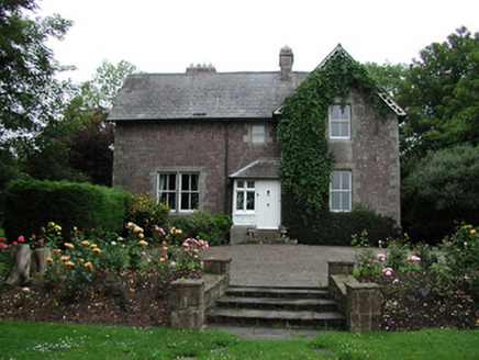 Glebe HouseRectory/glebe/vicarage/curate's house · 1197 ydCastleCastle, ringwork · 1729 yd
 The AlmshousesAlmshouse · 1.2 miBallyhourigan WoodsForest · 1.8 miTower (in Ruins)Bawn · 2.1 mi
 Keeper HillMountain / peak · 3.5 miThe Pollagh TrailNature reserve · 4.8 mi
 Slieve FelimMountain / peak · 5.1 mi
 Silvermines ViewpointViewpoint · 5.6 mi
 Cath.Cathedral · 5.9 mi
 Brian Boru Heritage CentreVisitor information · 6.0 mi
 TobermurraghHoly well · 6.3 mi
Pictures: National Inventory of Architectural Heritage; Sarah777, Wikimedia Commons · Public domain; Antony Dixon, Wikimedia Commons · CC BY-SA 2.0; Colin Park, Geograph · CC BY-SA 2.0; Andreas F. Borchert, Wikimedia Commons · CC BY-SA 4.0; P L Chadwick, Geograph · CC BY-SA 2.0; Oliver Dixon, Geograph · Creative Commons Attribution-ShareAlike 2.0
More archaeology and monuments in County Tipperary · All of County Tipperary
What do you know about this place?