What is recorded here
Marked 'Fort' on OS 1836 and 1876 eds. Raised circular area (int. diam. c. 35m) enclosed by a low earthen bank faced externally with drystone masonry and incorporated into the field boundary, and vague traces of a shallow fosse identifiable only from N-E-S. A low counterscarp bank surrounds the fosse. Original entrance not recognisable.
From the National Monuments Service (Archaeological Survey of Ireland) record CV042-043
Places near here
Photo credits
- National Inventory of Architectural Heritage
- Kieran Campbell, Geograph · CC BY-SA 2.0
- Mike Searle, Geograph · CC BY-SA 2.0
- Gavigan 01 at English Wikipedia, Wikimedia Commons · CC BY 2.5
- Colin Park, Geograph · CC BY-SA 2.0
- Britishfinance, Wikimedia Commons · CC BY-SA 4.0
- Sitomon, Wikimedia Commons · CC BY-SA 2.0
- Alvesgaspar, Wikimedia Commons · CC BY-SA 3.0
 Mass-rock in Dungummin LowerMass-rock · 1660 yd
Explorer Tom This Mass-rock in Dungummin Lower is a quiet stone marker where faith was kept alive, with records still being compiled.
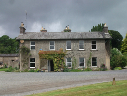 Farren ConnellCountry house · 1.3 mi
Explorer Tom Farren Connell’s country house dates back to around 1760, offering a glimpse into Cavan’s elegant rural past from the roadside.
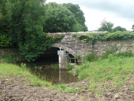 Ballinrink BridgeBridge · 1.3 mi
Explorer Tom Ballinrink Bridge incorporates remains of an earlier structure into its limestone arch, blending old history with new engineering across the Upper Inny.
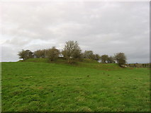 Fairy fort / earthen ringfort in Garrysallagh (o'reilly)Fairy fort / earthen ringfort · 1.4 mi
Explorer Tom This is the largest of four Garrysallagh ringforts, featuring three banks surrounding an interior of twenty-nine meters in diameter.
 CastleCastle, motte and bailey · 1.8 mi
 Ross CastleCastle, tower house · 2.1 mi
 MullaghmeenMountain / peak · 2.9 mi
 Mullaghmeen White WalkWalking route · 3.1 mi
 Mullaghmeen Red WalkWalking route · 3.1 mi
 Mullaghmeen ForestPicnic place · 3.4 mi
 European Yew5.8 mi
 Common Lime5.8 mi
More archaeology and monuments in County Cavan · All of County Cavan
What do you know about this place?Tap to add a comment or ask a question