What is recorded here
From the National Monuments Service (Archaeological Survey of Ireland) record CV015-060
The monument record does not grant public access. Check the route and ask the landowner before entering private land.
- What survives
- Recorded monument
Places near here
Photo credits
- Stephen Burton, Wikimedia Commons · CC BY-SA 2.0
- National Inventory of Architectural Heritage
- Adam Simpson, Geograph · CC BY-SA 2.0
- Oliver Dixon, Wikimedia Commons · CC BY-SA 2.0
- Peter Gerken, Geograph · CC BY-SA 2.0
- Algirdas at Lithuanian Wikipedia, Wikimedia Commons · Public domain
- Malene Thyssen, Wikimedia Commons · CC BY-SA 3.0
- NTF30, Wikimedia Commons · CC BY-SA 4.0
- Kenneth Allen, Geograph · CC BY-SA 2.0
 Carratraw BridgeBridge · 869 yd
Explorer Tom Carratraw Bridge is a five-arch stone road bridge from c.1800, connecting the mainland to Inis Mor island with robust squared rubble abutments.
Cornabrassan FortEnclosure · 1265 ydExplorer Tom Cornabrassan Fort in Inishmore sits in low-lying ground, enclosed by a substantial bank and deep fosse, with one breach likely marking its original entrance.
InishmuckIsland · 1268 ydExplorer Tom Inishmuck is a proper island in County Cavan, sitting proudly near Inishmuck Lough for anyone who likes a splash.
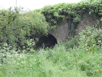 Blackstick BridgeBridge · 1343 yd
Explorer Tom Blackstick Bridge spans a road with a semi-circular arch, built c.1800 to improve transport and adding heritage charm to Drummany Beg.
 Clogh Oughter CastleCastle, Anglo-Norman masonry castle · 2.1 mi
Explorer Tom Clogh Oughter Castle sits on a tiny island in Lough Oughter, built by de Lacys around 1220; the O'Reillys took it back later, making it their royal fortress.
 Drumlane AbbeyHeritage attraction · 2.2 mi
Explorer Tom Drumlane Abbey features a round tower, with its lower part dating from the 10th or 11th century in County Cavan.
 Cloughoughter CastleIsland castle ruin · 2.7 mi
Explorer Tom Cloughoughter Castle stands as a ruin on an island in Lough Oughter, offering a dramatic and mysterious view across the water's surface.
 Rambling at Farnham EstateVisitor information · 3.2 mi
Explorer Tom Wandering the Rambling at Farnham Estate, I bet you can still feel the ghostly presence of that former stately home.
 Pedunculate Oak3.2 mi
Explorer Tom Yet another Pedunculate Oak in County Cavan, likely with deep, rugged bark and leaves that rustle softly, creating a natural symphony in the breeze.
 European Beech3.2 mi
Explorer Tom A stately European Beech in County Cavan, probably standing tall with smooth grey bark and leaves that turn coppery gold in autumn.
 Court tomb in GartnanoulCourt tomb · 3.5 mi
Explorer Tom This dual court tomb consists of two galleries placed back to back with a large space separating their back-stones.
 Mill WalkVisitor information · 3.9 mi
Explorer Tom Stroll Mill Walk heading SSW from Lower Bridge Street for a scenic route that reveals hidden corners of the old town.
More archaeology and monuments in County Cavan · All of County Cavan
What do you know about this place?