DDiscover AloneMapAbout

Ceremonial enclosure in Ringlestown

Ceremonial enclosure

The monument record does not grant public access. Check the route and ask the landowner before entering private land.

What survives
Recorded monument
What do you know about this place?Tap to add a comment or ask a question

What you write will be public.

What is recorded here

Located on top of a prominent hill. This is a large circular and slightly domed area (diam. c. 110m NW-SE; c. 105m NE-SW; H c. 1m) defined by an earthen bank (at SSE: Wth of base 13m; Wth of top 3.8m; int. H 1.3m) separated by a fosse (at SSE: Wth of top 10.5m; Wth of base 2m; ext. D 1m) from an outer bank (at SSE:…

Read the whole record
Located on top of a prominent hill. This is a large circular and slightly domed area (diam. c. 110m NW-SE; c. 105m NE-SW; H c. 1m) defined by an earthen bank (at SSE: Wth of base 13m; Wth of top 3.8m; int. H 1.3m) separated by a fosse (at SSE: Wth of top 10.5m; Wth of base 2m; ext. D 1m) from an outer bank (at SSE: Wth of base 5.3m; Wth of top 2m; ext. H 0.9m) which has an external facing of stones in places. There is a ditch or drain (Wth c. 2m; D 0.3m) inside the inner bank SE-S, and entrances through the inner bank at NE (Wth of base 2.75m) and SE (Wth of base 1.5m). There is also a gap (Wth of base 5m) at SE and gaps at NW (Wth of base 3m) and NNW (Wth of base 3m). The interior is planted with coniferous trees and there are deciduous trees on the outer bank. It is described as a defended enclosure or hillfort (Newman 1997, 198). Archaeological testing (18E0743) by D. Gallagher of an area (max. dims c. 160m WNW-ESE; c. 160m NNE-SSW) c. 50m to the W at the closest point produced no related material (excavations.ie 2019:691).

From the National Monuments Service (Archaeological Survey of Ireland) record ME037-005

Places near here

Picture notes
  • National Inventory of Architectural Heritage
  • C O'Flanagan, Geograph · Creative Commons Attribution-ShareAlike 2.0
  • Computer-made picture. It does not show this garden.
  • C O'Flanagan, Wikimedia Commons · CC BY-SA 2.0
  • Patrick Brown, Wikimedia Commons · CC BY-SA 2.0
  • Neil Forrester, Co.Meath, Ireland. http://neil.forrester.ie, Wikimedia Commons · CC BY 3.0
  • August Schwerdfeger, Wikimedia Commons · CC BY 4.0
  • Anthony Foster, Geograph · CC BY-SA 2.0
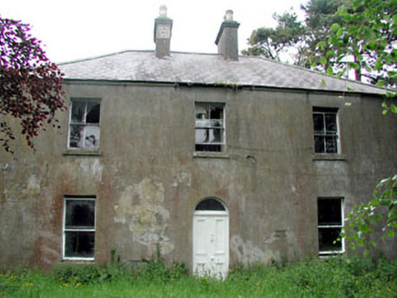
Conabery HouseFarm house · 1180 yd

Explorer Tom Conabery House has caught my eye in Kilmessan, County Meath. I bet a farm house with a name like that could keep me talking all afternoon; I'm already inventing a daft little scene for it, and I'll stop before it turns into history.

Saint Mary's Church (Kilmessan)Church/chapel · 1424 yd

Explorer Tom Saint Mary's Church (Kilmessan) has caught my eye in Kilmessan, County Meath. I bet a church/chapel with a name like that could keep me talking all afternoon; I'm already inventing a daft little scene for it, and I'll stop before it turns into history.

IndicatedGraveyard · 1439 yd

Explorer Tom Graveyard in Kilmessan has caught my eye in Kilmessan, County Meath. I bet a graveyard with a name like that could keep me talking all afternoon; I'm already inventing a daft little scene for it, and I'll stop before it turns into history.

CrockaphobbieWood · 1497 yd

Explorer Tom Crockaphobbie has caught my eye in County Meath. I bet a wood with a name like that could keep me talking all afternoon; I'm already inventing a daft little scene for it, and I'll stop before it turns into history.

Walled GardenGarden · 1664 ydComputer-made picture. It does not show this garden.

Explorer Tom Walled Garden has caught my eye in County Meath. I bet a garden with a name like that could keep me talking all afternoon; I'm already inventing a daft little scene for it, and I'll stop before it turns into history.

Beech & Oak WoodWood · 1.0 mi

Explorer Tom Beech & Oak Wood has caught my eye in County Meath. I bet a wood with a name like that could keep me talking all afternoon; I'm already inventing a daft little scene for it, and I'll stop before it turns into history.

Rath MeaveHenge · 1.4 mi

Explorer Tom Rath Meave has caught my eye in Belpere, Belpere, Odder, County Meath. I bet a henge with a name like that could keep me talking all afternoon; I'm already inventing a daft little scene for it, and I'll stop before it turns into history.

Battle of Tara (Ireland)Major battlefield · 1.5 mi

Explorer Tom Battle of Tara (Ireland) has caught my eye in County Meath. I bet a major battlefield with a name like that could keep me talking all afternoon; I'm already inventing a daft little scene for it, and I'll stop before it turns into history.

Battle of Tara HillBattle · 1.5 mi

Explorer Tom Battle of Tara Hill has caught my eye in County Meath. I bet a battle with a name like that could keep me talking all afternoon; I'm already inventing a daft little scene for it, and I'll stop before it turns into history.

Lia Fáil: Hill of TaraLegend location · 1.6 mi

Explorer Tom Lia Fáil: Hill of Tara is a stone with high standards. Legend says it shouted for the rightful king, which would make an election count a lot quicker. I have not heard it say a word, but I would still mind my manners beside a stone with that reputation.

Saint Patrick'sMemorial · 1.7 mi

Explorer Tom Saint Patrick's has caught my eye in County Meath. I bet a memorial with a name like that could keep me talking all afternoon; I'm already inventing a daft little scene for it, and I'll stop before it turns into history.

Hill of TaraVisitor information · 1.8 mi

Explorer Tom Hill of Tara has caught my eye in County Meath. I bet a visitor information with a name like that could keep me talking all afternoon; I'm already inventing a daft little scene for it, and I'll stop before it turns into history.

More archaeology and monuments in County Meath · All of County Meath

Add to this placeAdd a picture Add a detailed tip Add a story

Explore the map1,118,976 places to discover

Next place · or swipeConabery House