What is recorded here
Situated on a gentle SE-facing slope. Oval enclosure (max. dims. 35m N-S; 25m E-W) defined by a rubble wall (Wth c. 1.5m). It is now very overgrown and rubble from field clearance has been dumped on it, rendering it inaccessible.
From the National Monuments Service (Archaeological Survey of Ireland) record WI033-015
The monument record does not grant public access. Check the route and ask the landowner before entering private land.
- What survives
- Recorded monument
Places near here
IndicatedEnclosure · 245 yd The Old SchoolSchool · 697 ydSaint John's Church (Moyne)Church/chapel · 701 ydEnclosure in ArdnaboyEnclosure · 1402 ydLuke O'Toole MemorialMemorial · 2.3 miMangan's WoodForest · 3.2 miEagle HillMountain / peak · 3.5 mi(Site of) Castle LaurenceCastle, unclassified · 3.6 mi1798 Lacey Brothers MemorialMemorial · 3.6 miSessile Oak4.3 miClonmore Castle (in Ruins)Castle, Anglo-Norman masonry castle · 4.8 miCroaghanmoiraMountain / peak · 5.9 mi
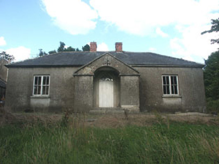 The Old SchoolSchool · 697 yd
 Saint John's Church (Moyne)Church/chapel · 701 ydEnclosure in ArdnaboyEnclosure · 1402 ydLuke O'Toole MemorialMemorial · 2.3 miMangan's WoodForest · 3.2 mi
 Eagle HillMountain / peak · 3.5 mi(Site of) Castle LaurenceCastle, unclassified · 3.6 mi1798 Lacey Brothers MemorialMemorial · 3.6 mi
 Sessile Oak4.3 mi
 Clonmore Castle (in Ruins)Castle, Anglo-Norman masonry castle · 4.8 mi
 CroaghanmoiraMountain / peak · 5.9 mi
Pictures: National Inventory of Architectural Heritage; Ridiculopathy, Wikimedia Commons · CC0; Jonathan Billinger, Geograph · CC BY-SA 2.0; Maker named on the Wikimedia Commons picture page · CC BY-SA 2.5; liam murphy, Wikimedia Commons · CC BY-SA 2.0; Britishfinance, Wikimedia Commons · CC BY-SA 4.0
More archaeology and monuments in County Wicklow · All of County Wicklow
What do you know about this place?