What is recorded here
Located on a sea promontory (dims. 170m ENE-WSW; 14m N-S at E to 59m N-S at W) covered in rough grass that slopes down to the N and E. The promontory is defended at W by an earthen bank (L 53m; Wth 4m; int. H 1.7m; ext. H 1.4m) with an outer fosse (Wth of base 3-4m) and an outer bank (L 91m; Wth 10-12m; ext. H 1.6m; H over the fosse 4m). There is an entrance through the outer bank (Wth 4.5m) and the inner bank (Wth 3m) with a causeway (Wth 3m) over the fosse. A raised rectangular feature (dims. 6.4m x 4.7m; H 0.3m) in the interior may be a hut site (Westropp 1906, 257 8). O’Conor (2003, 22-4) identifies the remains of two small ditches at the S end beyond the line of the defensive earthworks. They appear to be cut by the massive earthworks, which suggests to him that the large visible works are secondary and might have been re-fortified by Raymond le Gros in 1170 prior to an attack by the Ostmen of Waterford and their Irish allies (ibid. 24-5). The promontory fort is attached to a broader promontory (dims c. 400m ENE-WSW; c. 200m NNW-SSW) that is defended on the N (landward) side by the linear earthwork (WX050 015002-). 192/1952).
Located on a sea promontory (dims. 170m ENE-WSW; 14m N-S at E to 59m N-S at W) covered in rough grass that slopes down to the N and E. The promontory is defended at W by an earthen bank (L 53m; Wth 4m; int. H 1.7m; ext. H 1.4m) with an outer fosse (Wth of base 3-4m) and an outer bank (L 91m; Wth 10-12m; ext. H 1.6m; H over the fosse 4m). There is an entrance through the outer bank (Wth 4.5m) and the inner bank…
From the National Monuments Service (Archaeological Survey of Ireland) record WX050-015001
The monument record does not grant public access. Check the route and ask the landowner before entering private land.
- What survives
- Recorded monument
Places near here
Photo credits
- Paul O'Farrell, Geograph · CC BY-SA 2.0
- Andreas F. Borchert, Wikimedia Commons · CC BY-SA 4.0
- Oliver Dixon, Geograph · CC BY-SA 2.0
- Mike Searle, Geograph · CC BY-SA 2.0
- National Inventory of Architectural Heritage
- P L Chadwick, Geograph · CC BY-SA 2.0
- Sean O Briain, Geograph · CC BY-SA 2.0
- cisko66, Wikimedia Commons · CC BY 3.0
- Eirian Evans, Geograph · Creative Commons Attribution-ShareAlike 2.0
 Baginbun Martello TowerMartello tower · 177 yd
 Baginbun HeadHeadland · 256 yd
 Baginbun BeachBeach / strand · 337 yd
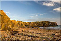 Carnivan BeachBeach / strand · 753 yd
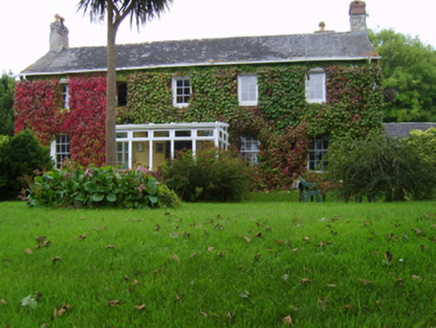 Ingard HouseHouse · 1758 yd
 Hook Tourism (Fethard Office)Visitor information · 1.3 mi
 Fethard CastleCastle, hall-house · 1.4 mi
 Houseland Castle (in ruins)Castle, tower house · 2.9 mi
 Windmill (in Ruins)Windmill · 3.0 mi
 Keeragh IslandsIsland · 4.0 mi
 Grave YardGraveyard · 4.2 mi
 Tintern AbbeyBuilding misc · 4.3 mi
More archaeology and monuments in County Wexford · All of County Wexford
What do you know about this place?