What is recorded here
Situated on the E tip of a low W-E spur. It is depicted as a circular embanked enclosure (ext. diam. c. 35-40m) on the 1836 edition of the OS 6-inch map where it is described in gothic lettering as a ‘Fort’. This is a circular grass-covered area (diam. 26m NW-SE; 26m NE-SW) defined by a scarp (Wth 1m; H 0.3-0.5m), that is partly stone-faced E-ESE. It is bisected by a NE-SW field wall and is best preserved SE of this. There is no visible fosse or entrance.
From the National Monuments Service (Archaeological Survey of Ireland) record ME009-023
Places near here
Photo credits
- National Inventory of Architectural Heritage
- Bob Embleton, Geograph · CC BY-SA 2.0
- Richard Webb, Geograph · CC BY-SA 2.0
- Bill Griffiths, Wikimedia Commons · CC BY-SA 2.0
- Haydn Hammerton, Wikimedia Commons · CC BY-SA 4.0
- James Fergusson, after E. Conwell, Wikimedia Commons · Public domain
- John M, Wikimedia Commons · CC BY-SA 2.0
- Wanfried-Dublin, Wikimedia Commons · CC BY-SA 4.0
- Alvesgaspar, Wikimedia Commons · CC BY-SA 3.0
- Sitomon, Wikimedia Commons · CC BY-SA 2.0
- Mike Searle, Geograph · CC BY-SA 2.0
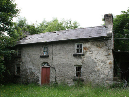 Behernagh HouseFarm house · 1595 yd
Explorer Tom A modest vernacular house from around eighteen hundred, this disused farmstead retains exposed sash boxes on its first floor windows.
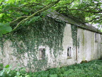 farm house1600 yd
Explorer Tom This vernacular farm house was built around 1800, is now disused, and features a decorative bargeboard to the south gable.
 Earthen TumulusCastle, motte · 1.8 mi
 IslandMountain / peak · 1.8 mi
Explorer Tom Island is a peak in County Cavan where the silage is safely in, despite the rain noted in its saved picture caption.
 Slieve Na CalliaghMountain / peak · 2.6 mi
 Loughcrew Megalithic TombsHeritage attraction · 2.6 mi
 Hag's ChairArchaeological place · 2.6 mi
 LoughcrewMegalithic tomb cemetery · 3.3 mi
 Ballaghanea Portal TombArchaeological place · 4.1 mi
Explorer Tom Ballaghanea Portal Tomb is recorded as an archaeological place in County Cavan, suggesting ancient stone structures that once marked this specific location.
 Common Lime4.1 mi
 European Yew4.1 mi
 MoatCastle, motte · 4.2 mi
More archaeology and monuments in County Meath · All of County Meath

What do you know about this place?Tap to add a comment or ask a question