DDiscover AloneMapAbout

Graveyard in Quingardens

Graveyard
Computer-made picture that does not show Graveyard in QuingardensNot a photo of this monument
Computer-made picture. It does not show this monument. · Report the wrong picture

The monument record does not grant public access. Check the route and ask the landowner before entering private land.

What do you know about this place?Tap to add a comment or ask a question

What you write will be public.

What is recorded here

Situated on the SE side of St Finghin’s church (CL042-027003-) built c. 1278 by Thomas de Clare (Westropp 1900-2, 148). A roughly rectangular graveyard (39m NE-SW; 24m NW-SE) bounded by the church at NW and elsewhere by a modern stone wall. The external ground level is lower outside the graveyard wall at E (int. H…

Read the whole record
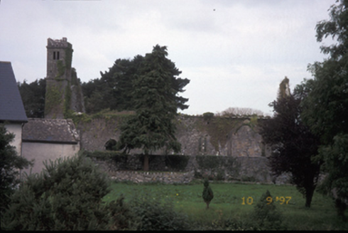
Situated on the SE side of St Finghin’s church (CL042-027003-) built c. 1278 by Thomas de Clare (Westropp 1900-2, 148). A roughly rectangular graveyard (39m NE-SW; 24m NW-SE) bounded by the church at NW and elsewhere by a modern stone wall. The external ground level is lower outside the graveyard wall at E (int. H 0.83m; ext. H 1.83m; Wth 0.65m). To S there is an even greater discrepancy in height (int. H 0.82m; ext. H 2.3m). Pre-development archaeological testing in 2008 (Licence no. E3921; Ruttle 2014, 12-18) located the probable original S boundary of the graveyard on the S side of this S wall at the lower level. Burials including skeletal remains of a person buried at the earliest in the 16th century were found in a roughly triangular area (10.2m x 8.9m x 7.3m). Boulders have been placed to mark the outline of the area and a plaque explaining this has been erected. Test trenching to the immediate N and E of St Finghin’s church (Carey 2003, 21, no. 89; Carey 2004, 51, no. 197; Licence no. 01E0573) uncovered disarticulated human bone and three skeletons oriented E-W. This may indicate that the medieval graveyard extended to this side. A curving field boundary to N and W c. 55m from the church, indicated on the OS 6-inch maps, shows St. Finghin's church centrally placed between that and the river Rine to the SE and may indicate the outline of the medieval precinct (CL042-027007-). The present graveyard boundary contains mainly 19th and 20th century burials and there is a mausoleum commemorating the Spaight family at NE. A later church is depicted and named 'St. Fineen's Church within this graveyard on the OS 1st edition 6-inch map and on the later editions. According to Ruttle (2014, 16) this was a Protestant church built next to St Finghin's in 1797. It was a small plain building with a low tower built by aid from the Board of First Fruits and was dismantled sometime after 1954 by the Board of Works. The church would have been attached to the S wall of the Spaight mausoleum and further remains are evident in the NE graveyard wall. The graveyard is accessed through a laneway at SW which originally lead directly to the later church. The following images have been uploaded: CL042-027004-_01.jpg Boulders outlining the S extent of the original graveyard. Modern graveyard wall behind with St. Finghin's church in the background. CL042-027004-_02.jpg Plaque erected to explain boulder area.

From the National Monuments Service (Archaeological Survey of Ireland) record CL042-027004

Places near here

Picture notes
  • National Inventory of Architectural Heritage
  • Computer-made picture. It does not show this monument.
  • NateBergin, Wikimedia Commons · CC BY 4.0
  • jule_berlin, Wikimedia Commons · CC BY 2.0
  • Computer-made picture. It does not show this playground.
  • Mike Searle, Wikimedia Commons · CC BY-SA 2.0
  • Didier Descouens, Wikimedia Commons · CC BY-SA 4.0
Saint Fineen's ChurchChurch/chapel · 12 yd

Explorer Tom Saint Fineen's Church in Quingardens is playing hard to get, ruined since 1878 after Thomas de Clare got grumpy. It’s just a lonely tower now, probably ignoring me on purpose. Bring a camera and your most suspicious face.

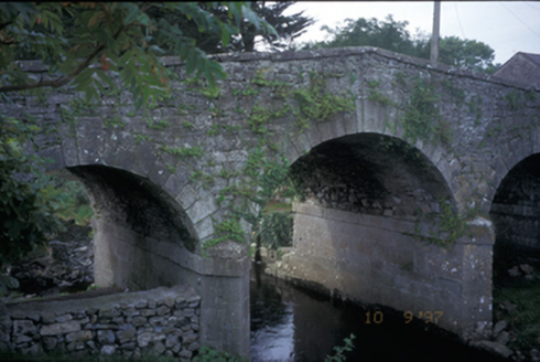
Quin BridgeBridge · 106 yd

Explorer Tom Quin Bridge is a triple-arch beast from 1800 with steps leading down to the river, which is basically a dare in stone form. It looks sturdy enough to survive a zombie horde, or at least make them trip on the steps. Dare you to say hello to it out loud; it might yawn.

Burial GroundGraveyard · 117 ydComputer-made picture

Explorer Tom Burial Ground in Quin is playing hide-and-seek by the river. It’s basically just a walled rectangle next to the abbey, but I bet it’s full of secrets. Go back in winter, it’s a different animal.

Graveslab in QuinGraveslab · 117 ydComputer-made picture

Explorer Tom Another Graveslab in Quin is missing its top and has no name either. It’s basically a blank canvas for your imagination. Stand where the owner stood and practise looking smug.

Quin Abbey ( in ruins)Religious house, Franciscan friars · 131 yd

Explorer Tom Quin Abbey (in ruins) in Quin does its best impression of a haunted house when nobody's looking. Make a wish, it's had centuries of practice.

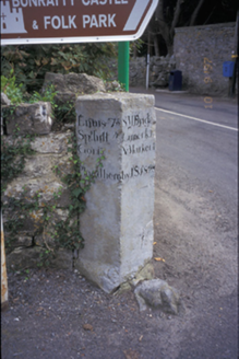
milestone/milepost132 yd

Explorer Tom Milestone in Quinville South was paid for by John Singleton, who clearly wanted his name etched into history forever. If anyone asks, Tom sent you.

Quin AbbeyHeritage attraction · 135 yd

Explorer Tom Quin Abbey is a medieval wonder in County Clare, where time has worn the stones but not the stories within its walls.

Wayside shrine140 ydComputer-made picture

Explorer Tom This unmarked wayside shrine in County Clare quietly marks the landscape, offering a small place for quiet devotion.

Children's playground583 ydComputer-made picture

Explorer Tom This Children's playground in County Clare is open for business, making it an ideal spot for families looking for a fun and friendly place to spend time with their kids.

Danganbrack Castle (in Ruins)Castle, tower house · 1078 yd

Explorer Tom Danganbrack Castle is covered in ivy like it's trying to cosplay as a garden gnomes' clubhouse. There's definitely a dog in charge of the front gate. Bring a camera and your most suspicious face.

Ballymarkahan Castle (in Ruins)Castle, tower house · 1.6 mi

Explorer Tom Ballymarkahan Castle in County Clare is playing hard to get, which is typical for a tower house with no public access. I reckon it's hiding in the hedgerows, laughing at my boots. Best visited with a curious kid and no timetable.

Hawthorn3.1 mi

Explorer Tom Hawthorn that looks like it's waiting for its turn in line for the pub. Go on, count the windows and get it wrong like I did.

More archaeology and monuments in County Clare · All of County Clare

Add to this placeAdd a picture Add a detailed tip Add a story

Explore the map1,093,392 places to discover

Next place · or swipeSaint Fineen's Church