What is recorded here
Situated on generally level ground on the W bank of the River Rine with a slight slope to the E. Listed as earthwork complex in the SMR (1992) and the RMP (1996). Curving field boundaries on the 1840 OS 6-inch map show St. Finghin’s church (CL042-027003-) to be centred within a subcircular area (130m NE-SW; 100m NW-SE) with the River Rine completing the circle NE-S. Present field walls to the W and N retain this curve. A survey of earthworks in this area in 1982 (SMR file) concluded that some of them were the remains of modern structures and possibly natural ridges. It was noted that the area may be associated with the settlement (CL042-027----) around Quin Abbey (CL042-027002-) on the E side of the river. Test trenching to the immediate N and E of St Finghin’s church (Carey 2003, 21, no. 89; Carey 2004, 51, no. 197; Licence no. 01E0573) uncovered disarticulated human bone and three skeletons oriented E-W indicating that the medieval graveyard also extended to this side. The line of a proposed pathway was altered on foot of this discovery. Several other trenches in the area produced no archaeological material.
Situated on generally level ground on the W bank of the River Rine with a slight slope to the E. Listed as earthwork complex in the SMR (1992) and the RMP (1996). Curving field boundaries on the 1840 OS 6-inch map show St. Finghin’s church (CL042-027003-) to be centred within a subcircular area (130m NE-SW; 100m NW-SE) with the River Rine completing the circle NE-S. Present field walls to the W and N retain this…
From the National Monuments Service (Archaeological Survey of Ireland) record CL042-027007
The monument record does not grant public access. Check the route and ask the landowner before entering private land.
- What survives
- Recorded monument
Places near here
Photo credits
- National Inventory of Architectural Heritage
- jule_berlin, Wikimedia Commons · CC BY 2.0
- NateBergin, Wikimedia Commons · CC BY 4.0
- Mike Searle, Wikimedia Commons · CC BY-SA 2.0
- C O'Flanagan, Wikimedia Commons · CC BY-SA 2.0
- Roger Diel, Wikimedia Commons · CC BY-SA 2.0
- Taco van der Waal, Wikimedia Commons · CC BY-SA 3.0
- Didier Descouens, Wikimedia Commons · CC BY-SA 4.0
- Yankiv121, Wikimedia Commons · CC BY-SA 4.0
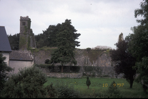 Saint Fineen's ChurchChurch/chapel · 55 yd
 Quin AbbeyHeritage attraction · 116 yd
 Quin Abbey ( in ruins)Religious house, Franciscan friars · 117 yd
_-_geograph.org.uk_-_4570420.jpg/250px-Castles_of_Munster_Ballymarkahan,_Clare_(2)_-_geograph.org.uk_-_4570420.jpg "Photo: Mike Searle, Wikimedia Commons · CC BY-SA 2.0") Ballymarkahan CastleCastle · 1.6 mi
Ballymarkahan CastleCastle · 1.6 mi.jpg/250px-Magh_Adhair,_Toonagh,_Co_Clare_(geograph_1954103).jpg "Photo: C O'Flanagan, Wikimedia Commons · CC BY-SA 2.0") Magh AdhairArchaeological place · 2.1 mi
Magh AdhairArchaeological place · 2.1 mi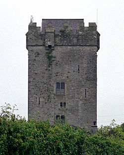 Castlefergus or Ballyhannan(in Rns) 1922Castle, tower house · 2.2 mi
 Mooghaun HillfortArchaeological place · 2.6 miMooghaun WoodsWood · 2.7 miCloghleagh RockNamed rock · 3.1 mi
 Hawthorn3.2 miCloghleagh RockNamed rock · 3.6 mi
 O'Connell ColumnMonument · 5.2 mi
More archaeology and monuments in County Clare · All of County Clare
What do you know about this place?