What is recorded here
Located in a level field of pasture W of the medieval church in the village of Newcastle (DU020-003005-). This is a broad flat-topped mound (diam. of base 26m; diam. of top 14m; H 5m). There is no evidence for a bailey. It was constructed c. 1200 AD (O'Keeffe 1986, 44-5). Austin Cooper writing in 1780 describes a very deep, wide fosse which is no longer apparent (Price (ed.) 1942, 27). DU020-003001-_01 Photograph courtesy of Tomás Maher, https://hdl.handle.net/10599/3707 © South Dublin Libraries - Local Studies
DU020-003001-_02 Photograph courtesy of Patrick Healy, https://hdl.handle.net/10599/2069 © South Dublin Libraries - Local Studies
DU020-003001-_02 Photograph courtesy of Rocshot.com/Rob O'Connor, https://hdl.handle.net/10599/10691, © South Dublin Libraries - Local Studies
Compiled by: Geraldine Stout
Revised by: Caimin O'Brien
Date of revised upload: 25 January 2023
From the National Monuments Service (Archaeological Survey of Ireland) record DU020-003001
The monument record does not grant public access. Check the route and ask the landowner before entering private land.
- What survives
- Recorded monument
Places near here
Settlement desertedSettlement deserted, medieval · 38 yd Saint Finian's Church (Newcastle)Church/chapel · 66 ydChurch in Newcastle NorthChurch · 73 ydEuropean Yew140 ydCastleCastle, tower house · 152 ydCastleCastle, tower house · 276 ydFont (present location) in Newcastle SouthFont (present location) · 387 ydSaint Finian's WellSpring · 479 ydAthgoe HillMountain / peak · 1627 ydGrand Canal WayWalking route · 1.3 miIcehouse WoodWood · 1.5 miInniscara GalleryGallery · 1.9 mi
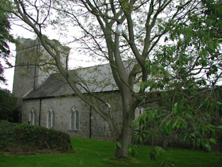 Saint Finian's Church (Newcastle)Church/chapel · 66 yd
 Church in Newcastle NorthChurch · 73 yd
 European Yew140 ydCastleCastle, tower house · 152 yd
 CastleCastle, tower house · 276 ydFont (present location) in Newcastle SouthFont (present location) · 387 ydSaint Finian's WellSpring · 479 ydAthgoe HillMountain / peak · 1627 yd
 Grand Canal WayWalking route · 1.3 miIcehouse WoodWood · 1.5 miInniscara GalleryGallery · 1.9 mi
Pictures: National Inventory of Architectural Heritage; Sarah777 at en.wikipedia, Wikimedia Commons · Public domain; Sitomon, Wikimedia Commons · CC BY-SA 2.0; Mike Searle, Geograph · CC BY-SA 2.0; JP, Geograph · CC BY-SA 2.0
More castles and forts in County Dublin · All of County Dublin
What do you know about this place?