
Places near here
Photo credits
- National Inventory of Architectural Heritage
- Richard Webb, Geograph · CC BY-SA 2.0
- Kmcnamee, Wikimedia Commons · CC BY-SA 4.0
- Mike Searle, Wikimedia Commons · CC BY-SA 2.0
- Hywel Williams, Geograph · CC BY-SA 2.0
- Ryanforsyth9, Wikimedia Commons · CC BY-SA 4.0
- Oliver Dixon, Geograph · CC BY-SA 2.0
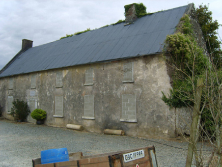 Newbawn HouseFarm house · 758 yd
Explorer Tom Newbawn House in Newbawn would rate its visitors two stars for effort and one star for bringing their own mops, which…
 graveyard/cemetery884 yd
Explorer Tom Graveyard or cemetery in Newbawn would describe itself as a quiet place where the past is still very much alive and…
 Carrickbyrne HillMountain / peak · 2.3 mi
Explorer Tom Carrickbyrne Hill would be the uncle at a wedding who eats too much and falls asleep before the cake. It’s got that…
 Clongeen GAAGAA ground · 2.4 miRathgarogue-Cushinstown GAAGAA ground · 3.2 mi
 Castle (in ruins)Castle, tower house · 4.6 mi
Explorer Tom Castle in Tellarought once had a huge argument about whether it was actually haunted or just really bad at maintaining…
 Rathumney Castle (in ruins)Castle, hall-house · 4.9 mi
Explorer Tom Rathumney Castle in County Wexford is actually short for 'The House Where Nobody Can Agree On The Date'. It’s been…
 Lacken HillMountain / peak · 6.1 mi
Explorer Tom Lacken Hill would say in a job interview that it has strong leadership skills, mostly because it’s got a monument on…
 1798 MonumentMonument · 6.1 mi
Explorer Tom 1798 Monument claims to be older than the concept of coffee, which is a stretch even by Wexford standards. It remembers…
 Forest Of The DunbrodyForest · 6.3 mi
Explorer Tom Forest Of The Dunbrody is where smugglers hid their contraband, or at least that's what the trees whisper while they're…
 Blackhall StrandBeach / strand · 8.7 mi
Explorer Tom Blackhall Strand in County Wexford would teach history by pointing at rocks and saying, 'I was here when that…
 Windmill8.7 mi
Explorer Tom Windmill in Cullenstown bragged about surviving a storm that actually just blew its own roof off and made it look like…
More archaeology and monuments in County Wexford · All of County Wexford

What do you know about this place?Tap to add a comment or ask a question