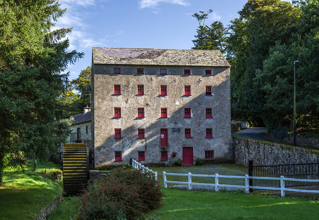
What is recorded here
Detached five-bay five-storey mill, dated 1851, on a rectangular plan. Reroofed, 1980. Closed, 1998. Now disused. Replacement pitched slate roof on strutted King post timber construction with lichen-covered clay ridge tiles, and remains of cast-iron rainwater goods on slate flagged eaves. Lime rendered or roughcast coursed rubble stone battered walls with concealed cut- or hammered granite flush quoins to corners. Square-headed window openings centred on square-headed loading opening (first floor) with shallow sills, and concealed red brick block-and-start surrounds framing six-over-three timber sash windows having part exposed sash boxes centred on timber boarded fitting (first floor). Interior including (ground floor): riven flag stone floor, and timber boarded ceiling on timber joists on timber beams on timber corbels; (upper floors): timber boarded ceilings on timber joists on timber beams on timber corbels. Set back from road with hardcore gravel forecourt.
A mill 'erected by Richard Purcell [----]' representing an important component of the mid nineteenth-century industrial heritage of south County Wexford with the architectural value of the composition, one repurposing stone work from an eighteenth-century mill ("1743") marked on the first edition of the Ordnance Survey (surveyed 1840; published 1841), confirmed by such attributes as the compact rectilinear plan form; and the uniform or near-uniform proportions of the openings on each floor. Having been reasonably well maintained, the elementary form and massing survive intact together with substantial quantities of the original fabric, both to the exterior and to the interior including not only a set of mill stones supplied (1860) by Pearson and Company of Dublin, but also a breastshot waterwheel pinpointing the engineering or technical dexterity of a mill making an imposing visual statement overlooking the Corock River.
This does not grant access. Most recorded buildings are privately owned; view them only from public ground unless the owner allows entry.
Places near here
 Foulkesmill Bridgebridge · 70 yd
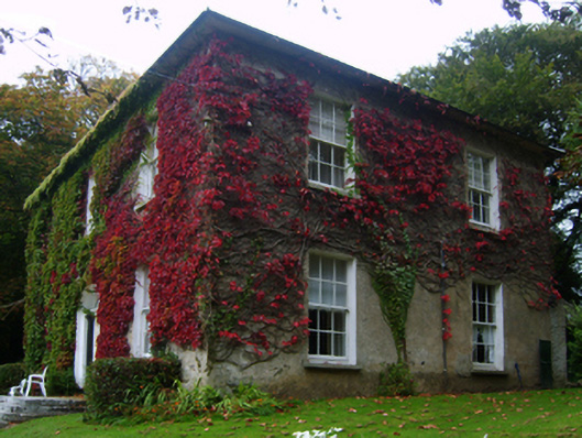 farm housefarm house · 144 yd
 IndicatedField boundary · 1499 yd
 Embanked enclosureFairy fort / ringfort · 1700 yd
 CastleCastle, tower house · 1.6 mi
 Bawn in Tracystown WestBawn · 2.1 mi
 Carrickbyrne HillMountain / peak · 4.1 mi
 Lockheed Hudson AM885 MemorialMemorial · 4.9 mi
 Camaross HillMountain / peak · 5.0 mi
 Carrig-On-BannowVisitor information · 5.3 mi
 1798 MemorialMemorial · 5.3 mi
 Cullenstown StrandBeach / strand · 6.8 mi
Other information
Photo: Mike Searle · CC BY-SA 2.0