What is recorded here
Situated on a marked W-facing slope. A small circular enclosure hachured on the 1938 OS 6-inch map, and indicated on the 1907 edition (max. diam. c. 30m). The site is in forestry, and could not be located.
From the National Monuments Service (Archaeological Survey of Ireland) record WI038-002
The monument record does not grant public access. Check the route and ask the landowner before entering private land.
- What survives
- Recorded monument
Places near here
Raheen (Site of)Fairy fort / ringfort · 666 ydBallycumber HillMountain / peak · 1016 ydIndicatedFairy fort / earthen ringfort · 1.3 mi The Old SchoolSchool · 1.5 miSaint John's Church (Moyne)Church/chapel · 1.5 miLuke O'Toole MemorialMemorial · 1.6 mi1798 Lacey Brothers MemorialMemorial · 2.9 miEagle HillMountain / peak · 3.3 miClonmore MoatCastle, motte and bailey · 3.6 miClonmore Castle (in Ruins)Castle, Anglo-Norman masonry castle · 4.1 miSessile Oak4.5 miSweet Chestnut4.9 mi
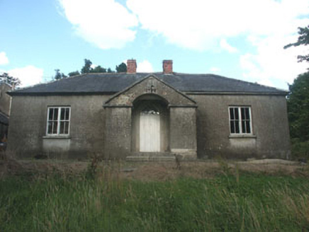 The Old SchoolSchool · 1.5 mi
 Saint John's Church (Moyne)Church/chapel · 1.5 miLuke O'Toole MemorialMemorial · 1.6 mi1798 Lacey Brothers MemorialMemorial · 2.9 mi
 Eagle HillMountain / peak · 3.3 miClonmore MoatCastle, motte and bailey · 3.6 mi
 Clonmore Castle (in Ruins)Castle, Anglo-Norman masonry castle · 4.1 mi
 Sessile Oak4.5 mi
 Sweet Chestnut4.9 mi
Pictures: National Inventory of Architectural Heritage; Ridiculopathy, Wikimedia Commons · CC0; Jonathan Billinger, Geograph · CC BY-SA 2.0; liam murphy, Wikimedia Commons · CC BY-SA 2.0; Maker named on the Wikimedia Commons picture page · CC BY-SA 2.5; Miguel Angel Masegosa Martínez, Wikimedia Commons · CC BY 2.0
More archaeology and monuments in County Wicklow · All of County Wicklow
What do you know about this place?