Places near here
Photo credits
- Kenneth Allen, Geograph · CC BY-SA 2.0
- National Inventory of Architectural Heritage
- Stan Courtney, Geograph · CC BY-SA 2.0
- Sitomon, Wikimedia Commons · CC BY-SA 2.0
- Andreas F. Borchert, Wikimedia Commons · CC BY-SA 4.0
- Simonchadwick1023, Wikimedia Commons · CC BY-SA 4.0
 Old Church (in Ruins)Church · 617 yd
Explorer Tom Old Church in Drumswords was the centre of a massive parish argument that ended in a draw. It sits on a slope like a grumpy old man refusing to move. Bring a flask, take a seat on the wall, and act like you own the whole estate.
 Saint Mary's Catholic ChurchChurch/chapel · 807 yd
Explorer Tom Saint Mary’s Catholic Church in Aghnamard has a stone tower that stands out like a sore thumb against the rendered walls. The whole parish once argued about whether the hood-mouldings were too fancy for a church, and nobody agreed. Whisper a secret into the stonework and see if it echoes back to you later.
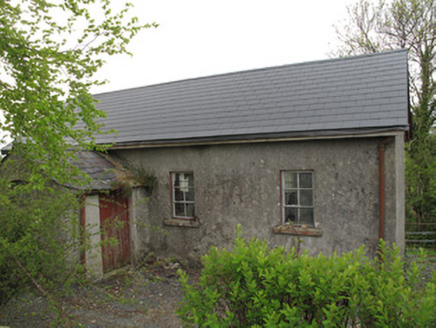 Ture National SchoolSchool · 834 yd
Explorer Tom Ture National School was designed by a mother-in-law who liked chamfered corners for safety. It sits next to the church, looking modest but surprisingly sturdy against traffic. Bring sandwiches, the ghost of a teacher might offer you one.
 Carn WoodForest · 1385 yd
 European Yew1.4 mi
 Standing stone in ScarvyStanding stone · 1.6 mi
Explorer Tom Standing stone in Scarvy is hiding a treasure chest that definitely contains only a biscuit tin and some old newspapers from 1954. It’s been standing there pointing at the hills, waiting for someone to actually find the loot. Find a local and ask them the real story, then come back and tell me.
LattacrossanMountain / peak · 2.7 mi Ulster Canal Stores Visitor CentreHeritage attraction · 2.8 mi
 Shrine in CrossmoyleShrine · 2.8 mi
Explorer Tom Shrine in Crossmoyle would post 'Just woke up from a thousand-year nap' on social media. It looks like a tiny wooden church carved from sandstone. Bring a jacket, it's never as warm as I promise.
 Abbey RuinsHeritage attraction · 2.8 miSaint John's WellSpring · 2.9 miSandhillsMountain / peak · 3.3 mi
More archaeology and monuments in County Monaghan · All of County Monaghan

What do you know about this place?Tap to add a comment or ask a question