
Places near here
Photo credits
- National Inventory of Architectural Heritage
- Mike Searle, Geograph · CC BY-SA 2.0
- James Allan, Wikimedia Commons · CC BY-SA 2.0
- Malene Thyssen, Wikimedia Commons · CC BY-SA 3.0
- Alvesgaspar, Wikimedia Commons · CC BY-SA 3.0
- Rathkennamike2, Wikimedia Commons · CC BY-SA 4.0
- Andreas F. Borchert, Wikimedia Commons · CC BY-SA 4.0
- Robin Pollard, Wikimedia Commons · CC BY 3.0
- Sitomon, Wikimedia Commons · Public domain
- Tjp finn, Wikimedia Commons · CC BY-SA 4.0
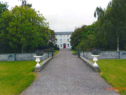 Parkstown HouseCountry house · 1.3 mi
Explorer Tom Parkstown House has a family tree that’s mostly made up of imaginary cousins and a very aggressive gardener. The stone doorcase is doing its best classical impression without breaking a sweat. Bring a notebook and write down something impressive-sounding.
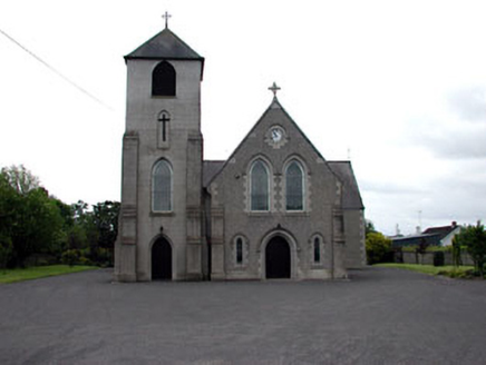 Saint Columbanus's Catholic ChurchChurch/chapel · 1.4 mi
Explorer Tom Saint Columbanus's Catholic Church in Kilballivor seems to suspect the postman of stealing its holy relics. It’s got these fancy iron railings that say 'keep out unless you’re very important.' Hum something sad nearby, it likes the drama.
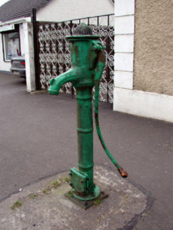 water pump1.4 mi
 CastleCastle, tower house · 1.7 mi
Explorer Tom Castle in Donore is playing hide-and-seek with me, but I think it’s hiding behind its own ego. A local claims he invented the whole tower-house concept just to annoy his neighbours. Perfect spot for rehearsing an excuse for being late.
 Donore CastleCastle · 1.7 mi
 European Beech2.2 mi
Explorer Tom European Beech in County Meath is sick of people asking if it talks to the other trees; yes, they gossip, shut up. It’s got that tired look of someone who’s heard every question before. Bring a flask of something warm and a story to swap.
 Common Lime2.3 mi
Explorer Tom Common Lime in County Meath once hid a crate of smuggled whiskey in its roots during a particularly rainy century. The bark still smells faintly of rum and bad decisions. Go back in winter, it's a different animal.
 Grave YardGraveyard · 4.2 mi
Explorer Tom Graveyard in Kildalkey has strict rules: no yelling, no shoes, and absolutely no talking about politics. It started as a circle but expanded because people kept showing up. Have a look and decide if I was lying.
 Site of AbbeyChurch · 5.4 mi
Explorer Tom Site of Abbey in Anneville or Clonard Old would complain to the council about how many students St. Finnian actually graduated. Twelve apostles? Give me a break, that’s just wishful thinking by medieval PR guys. Tell it a joke, it's been a long time since anyone did.
.jpg/250px-Croppies_Grave_Clonard_-_panoramio_(1).jpg "Photo: Robin Pollard, Wikimedia Commons · CC BY 3.0") Croppies' GraveMemorial · 6.1 mi
Croppies' GraveMemorial · 6.1 miExplorer Tom Croppies' Grave marks where rebels fell, and someone wrote a terrible poem about it that rhymed 'blood' with 'mud'. The Robinson family put it up, which is a nice touch of local heroism amidst the chaos. Go now, before it gets famous and starts charging entry fees.
 KnowthArchaeological place · 22 mi
Explorer Tom You see one mound? Give Knowth another minute to complicate your day. Knowth looks like one enormous grassy mound in the Boyne Valley until its stonework starts giving away the plot. The main monument, built around 3200 BC, holds two separate passages, one entering from the east and one from the west. Around its base stood 127 kerbstones, and excavators found more than 200 carved stones, including art hidden on faces that visitors would not normally have seen. If I could read every carved line, I would still let the builders keep a few secrets. That is quite a private gallery for a place already making a public impression. Centuries later people built a royal residence on top, using the old mound for a new kind of authority. Knowth is part of the Brú na Bóinne heritage complex, and visits are managed through the visitor arrangements there; check current booking and access before going. Study the carved spirals, but leave the ancient builders at least one secret they can keep.
 NewgrangeHeritage attraction · 23 mi
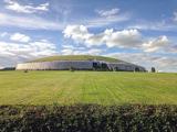
Explorer Tom You reckon you are punctual? Try keeping an appointment for five thousand years. Newgrange is older than Stonehenge, but it still knows how to make an entrance. At the winter solstice, sunrise reaches through a small roofbox above the doorway and lights the chamber at the end of a passage about 19 metres long. Imagine hauling roughly 200,000 tonnes of earth and stone into a mound, then arranging for the sun to make a punctual visit. That little roofbox has better timekeeping than me, and it has never owned a watch. The entrance stone weighs about five tonnes and carries carved spirals; elsewhere, some carvings were placed on faces that would be hidden under the finished structure. That is an extraordinary amount of work for an audience of almost nobody. Twelve standing stones remain from a possible circle of thirty-eight, and the bright quartz front you see today includes a twentieth century reconstruction that archaeologists still debate. The mound is a monument, not an open shortcut into a chamber, so follow the site's visitor arrangements for entry. I will be outside, trying to arrive on time for something for once.
More archaeology and monuments in County Meath · All of County Meath

What do you know about this place?Tap to add a comment or ask a question