
What is recorded here
The parish church of Kildalkey (ME029-020----) is situated on a rise in a level landscape and was within a circular graveyard (diam. c. 50-60m), which is defined by a low scarp (H c. 0.5m). The graveyard is now extended into a large sub-rectangular cemetery (dims c. 140m NW-SE; 45-70m NE-SW) extending off to the W, which is defined by masonry and cement walls. The holy well (ME029-020002-) is c. 40m to the E of the old graveyard.
The parish church of Kildalkey (ME029-020----) is situated on a rise in a level landscape and was within a circular graveyard (diam. c. 50-60m), which is defined by a low scarp (H c. 0.5m). The graveyard is now extended into a large sub-rectangular cemetery (dims c. 140m NW-SE; 45-70m NE-SW) extending off to the W, which is defined by masonry and cement walls. The holy well (ME029-020002-) is c. 40m to the E of…
From the National Monuments Service (Archaeological Survey of Ireland) record ME029-020001
The monument record does not grant public access. Check the route and ask the landowner before entering private land.
- What survives
- Recorded monument
Places near here
Photo credits
- National Inventory of Architectural Heritage
- Mike Searle, Geograph · CC BY-SA 2.0
- Kieran Campbell, Geograph · CC BY-SA 2.0
- Kieran Campbell, Geograph · Creative Commons Attribution-ShareAlike 2.0
- Billy Irwin, Wikimedia Commons · CC BY-SA 2.0
- Malene Thyssen, Wikimedia Commons · CC BY-SA 3.0
- Alvesgaspar, Wikimedia Commons · CC BY-SA 3.0
- Robin Pollard, Wikimedia Commons · CC BY 3.0
- Aubrey Martin, Wikimedia Commons · CC BY-SA 4.0
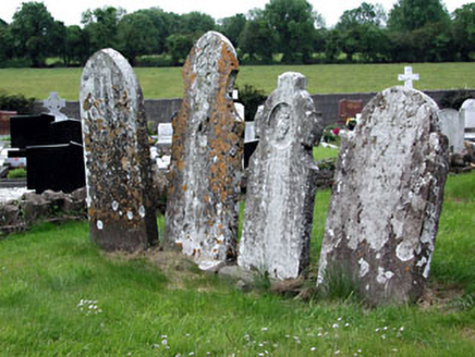 Saint Dympna's CemeteryGraveyard/cemetery · 5 yd
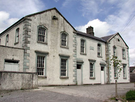 Saint Dympna's HallAlmshouse · 430 yd
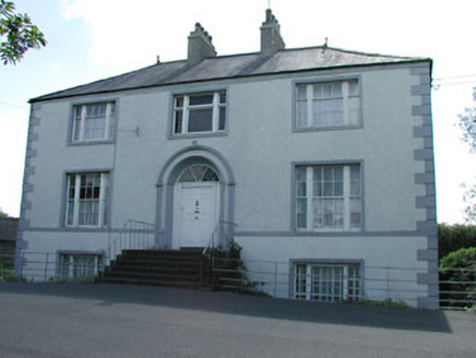 presbytery/parochial/curate's house486 yd
 Moyrath CastleCastle, tower house · 1.1 mi
 Fraine CastleCastle, tower house · 2.0 mi
 IndicatedGatehouse · 3.4 mi
 Grave YardGraveyard · 4.8 mi
 Trim CastleVisitor information · 5.0 mi
 European Beech6.3 mi
 Common Lime6.3 mi
.jpg/250px-Croppies_Grave_Clonard_-_panoramio_(1).jpg "Photo: Robin Pollard, Wikimedia Commons · CC BY 3.0") Croppies' GraveMemorial · 10 mi
Croppies' GraveMemorial · 10 mi Donaghmore Round TowerHeritage attraction · 12 mi
More archaeology and monuments in County Meath · All of County Meath
What do you know about this place?