
Places near here
Photo credits
- Royalcanalrunner, Wikimedia Commons · CC BY-SA 4.0
- National Inventory of Architectural Heritage
- Mike Searle, Geograph · CC BY-SA 2.0
- Alvesgaspar, Wikimedia Commons · CC BY-SA 3.0
- Robin Pollard, Wikimedia Commons · CC BY 3.0
- Malene Thyssen, Wikimedia Commons · CC BY-SA 3.0
- Andreas F. Borchert, Wikimedia Commons · CC BY-SA 4.0
- Garry Dickinson, Geograph · CC BY-SA 2.0
 Moyvally BridgeBridge · 1001 yd
Explorer Tom Moyvally Bridge on the Royal Canal is hiding a secret message in its stones, I swear. The masonry is crisp enough to cut your cheek if you lean too far. Bring biscuits, every goer will eat them.
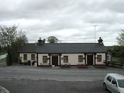 Furey'sHouse · 1002 yd
Explorer Tom Furey's in Moyvally is being judged by a sheep who thinks timber frames are overrated and too flimsy. The locals say the animal actually approves of the symmetrical front, which I find hard to believe. Bring someone who'll believe you when you say that.
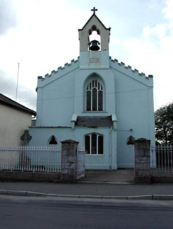 Catholic Church of the AssumptionChurch/chapel · 1.2 mi
Explorer Tom Catholic Church of the Assumption in Longwood is secretly proud of one specific potato it grew inside the walled garden years ago. The castellations make it look like a tiny, very serious castle in the middle of town. Look for the ghost, the one who likes gardens.
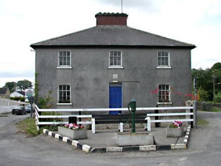 Longwood Garda Síochána StationHouse · 1.2 mi
Explorer Tom Longwood Garda Station sits at the end of the street like it refuses to fall down out of pure stubbornness. The timber windows look like they’ve seen some real drama. Mind the nettles, they're the actual security detail here.
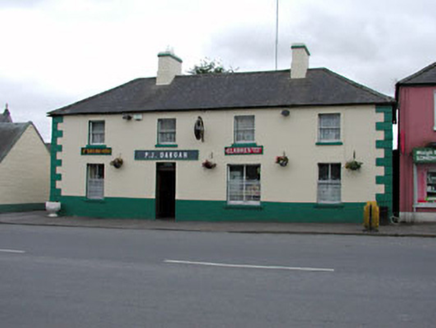 P.j. DarganHouse · 1.2 mi
Explorer Tom P.j. Dargan in Longwood would tell a teenager the 1800s were basically just a long queue for tea. Its wrought-iron window guards are stronger than your willpower to study. Bring a notebook; it has plenty of stories to tell you.
 Bawn in Newcastle (moyfenrath Lower By.)Bawn · 2.6 mi
Explorer Tom Bawn in Newcastle is actually a fancy word for a wall that forgot how to hold itself together properly. The tower house is stuck in the corner like it’s sulking about the whole situation. Make up your own legend and I'll swear it's true.
 Common Lime3.4 mi
Explorer Tom Common Lime in County Meath once hid a crate of smuggled whiskey in its roots during a particularly rainy century. The bark still smells faintly of rum and bad decisions. Go back in winter, it's a different animal.
.jpg/250px-Croppies_Grave_Clonard_-_panoramio_(1).jpg "Photo: Robin Pollard, Wikimedia Commons · CC BY 3.0") Croppies' GraveMemorial · 3.4 mi
Croppies' GraveMemorial · 3.4 miExplorer Tom Croppies' Grave marks where rebels fell, and someone wrote a terrible poem about it that rhymed 'blood' with 'mud'. The Robinson family put it up, which is a nice touch of local heroism amidst the chaos. Go now, before it gets famous and starts charging entry fees.
 European Beech3.4 mi
Explorer Tom European Beech in County Meath is sick of people asking if it talks to the other trees; yes, they gossip, shut up. It’s got that tired look of someone who’s heard every question before. Bring a flask of something warm and a story to swap.
 Site of AbbeyChurch · 3.8 mi
Explorer Tom Site of Abbey in Anneville or Clonard Old would complain to the council about how many students St. Finnian actually graduated. Twelve apostles? Give me a break, that’s just wishful thinking by medieval PR guys. Tell it a joke, it's been a long time since anyone did.
 CastleCastle, motte · 4.0 mi
Explorer Tom This motte in Anneville is basically a giant grassy donut waiting for Saint Patrick to come back and critique its landscaping. He’d probably say it’s too fancy for his taste, but I’m sure he’s wrong. Go in good boots and better humour, mate.
 Font (present location) in TowlaghtFont (present location) · 4.3 mi
Explorer Tom Font in Towlaght was moved from an old church to St Finian's in 1991. It’s carved with biblical scenes and looks like it has seen better days. It's free, it's odd, what more do you want?
More archaeology and monuments in County Kildare · All of County Kildare

What do you know about this place?Tap to add a comment or ask a question