
What is recorded here
From the National Monuments Service (Archaeological Survey of Ireland) record WX026-011
Places near here
Photo credits
- Maker not stated on source page, tr.pinterest.com
- Maker not stated on source page, it.pinterest.com
- Maker not stated on source page, ru.pinterest.com
- National Inventory of Architectural Heritage
- Maker not stated on source page, www.theirishroadtrip.com
- Maker not stated on source page, commons.m.wikimedia.org
 Site of ChurchChurch · 1214 yd
Explorer Tom Site of Church in Kilbride would post a selfie of its own foundation stones if it could. It’s been cut by a field bank…
 The Ballagh CemeteryCemetery · 1.5 mi
Explorer Tom The Ballagh Cemetery in County Wexford is like that awkward uncle at weddings who stands by the cake table judging…
 Ballaghkeen Old GraveyardGraveyard · 1.6 mi
Explorer Tom Ballaghkeen Old Graveyard in County Wexford is haunted by a fiddler who played until his fingers fell off. He’s still…
 graveyard/cemetery1.6 mi
Explorer Tom The graveyard in Ballymurry has set a New Year’s resolution to stop being so spooky and start having more fun picnics…
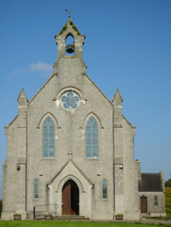 Catholic Church of Saint John the BaptistChurch/chapel · 1.6 mi
Explorer Tom Catholic Church of Saint John the Baptist in Ballymurry is pretending to be a royal stopover because someone said so in…
 Fairy fort / ringfort in KilpierceFairy fort / ringfort · 1.7 mi
Explorer Tom Fairy fort / ringfort in Kilpierce had a fox take charge for a week. It barked at the sheep and declared itself king of…
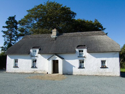 farm house1.8 mi
Explorer Tom Farm house in Ballymoty Beg was built by a matchmaker who only paired up cows for love, which explains the mud daubing.…
 Moated enclosureMoated site · 1.8 mi
Explorer Tom Moated enclosure in Glentire is basically a giant mud puddle pretending to be a fortress. If your neighbour peeks over…
Fairy fort / earthen ringfort in BallymacoonogeFairy fort / earthen ringfort · 1.9 miExplorer Tom Fairy fort in Ballymacoonoge would take its lotto win and buy a bigger ditch, just to see if the neighbours were…
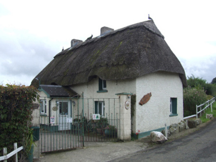 Primrose CottageFarm house · 1.9 mi
Explorer Tom Primrose Cottage thinks it’s too fancy for mud, yet the census says it’s basically daub and dreams. It’d walk into a…
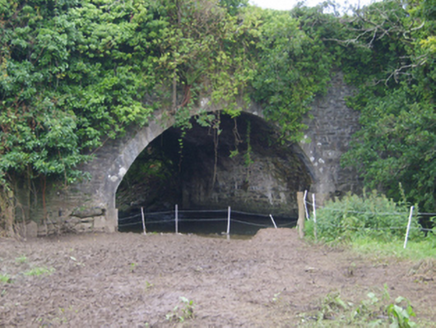 Cooladine BridgeBridge · 2.0 mi
Explorer Tom Cooladine Bridge in Cooladine was designed by James Barry Farrell and has an elegant arch sweep. I bet it complains…
 Church (in ruins)Church · 2.1 mi
Explorer Tom Church in Killisk would tell the new church that replaced it, 'You're lucky you didn't have to deal with my circular…
More archaeology and monuments in County Wexford · All of County Wexford

What do you know about this place?Tap to add a comment or ask a question