
What is recorded here
Situated on a slight rise on the gentle W-facing slope of a low hill. The parish church of Killisk is within a circular enclosure which is truncated by an E-W laneway at S and is now D-shaped (dims 39m E-W; 32m N-S). The enclosure is defined by an earthen bank (Wth 3-8m; H 0.3-0.7m). The nave (ext. dims 10.5m E-W;…
Read the whole record
From the National Monuments Service (Archaeological Survey of Ireland) record WX027-025001
Places near here
Photo credits
- National Inventory of Architectural Heritage
- Maker not stated on source page, www.theirishroadtrip.com
- Maker not stated on source page, commons.m.wikimedia.org
- Maker not stated on source page, tr.pinterest.com
- Maker not stated on source page, ru.pinterest.com
- Maker not stated on source page, it.pinterest.com
- Colin Park, Geograph · CC BY-SA 2.0
- Break0990, Wikimedia Commons · CC BY-SA 4.0
- liam murphy, Wikimedia Commons · CC BY-SA 2.0
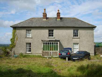 farm house1574 yd
Explorer Tom Farm house in Tinraheen has a doorcase that’s hiding behind a porch, like it’s playing hide-and-seek with itself. It’s…
 Fairy fort / earthen ringfort in BallymacoonogeFairy fort / earthen ringfort · 1.3 mi
Explorer Tom Fairy fort in Ballymacoonoge would take its lotto win and buy a bigger ditch, just to see if the neighbours were…
 Moated enclosureMoated site · 1.4 mi
Explorer Tom Moated enclosure in Garryntinodagh hosted a dance that went too far. Someone stepped on the moat edge, fell in, and…
 Site of ChurchChurch · 1.5 mi
Explorer Tom Site of Church in Kilbride would post a selfie of its own foundation stones if it could. It’s been cut by a field bank…
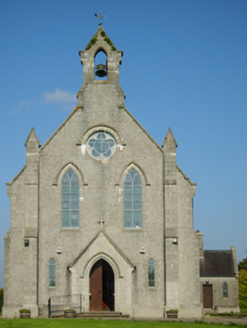 Catholic Church of Saint John the BaptistChurch/chapel · 1.5 mi
Explorer Tom Catholic Church of Saint John the Baptist in Ballymurry is pretending to be a royal stopover because someone said so in…
 graveyard/cemetery1.6 mi
Explorer Tom The graveyard in Ballymurry has set a New Year’s resolution to stop being so spooky and start having more fun picnics…
 Ballaghkeen Old GraveyardGraveyard · 1.6 mi
Explorer Tom Ballaghkeen Old Graveyard in County Wexford is haunted by a fiddler who played until his fingers fell off. He’s still…
 The Ballagh CemeteryCemetery · 1.6 mi
Explorer Tom The Ballagh Cemetery in County Wexford is like that awkward uncle at weddings who stands by the cake table judging…
 Ballinkeel HouseGate lodge · 1.9 mi
Explorer Tom Ballinkeel House is a gate lodge designed in the picturesque fashion, which means it’s deliberately trying to look…
 Vinegar HillMountain / peak · 5.3 mi
Explorer Tom Vinegar Hill rises above Enniscorthy with a name that sounds as though the countryside has been arguing with a bottle…
 Battle of Vinegar Hill, 1798Monument · 5.3 mi
Explorer Tom Battle of Vinegar Hill 1798 started because two lads made a bet in the pub that nobody could tell where the hill ended.…
 Battlefield in Clonhasten,drumgold,templeshannonBattlefield · 5.3 mi
Explorer Tom Battlefield in Clonhasten is still trying to outdo Vinegar Hill, which is brave given it’s just a muddy patch of dirt.…
More historic places in County Wexford · All of County Wexford

What do you know about this place?Tap to add a comment or ask a question