What is recorded here
In pasture, adjacent to a modern farmstead, located 30m N of a stream/drain in gently undulating terrain, with a broad expanse of wet, boggy ground c. 200m to W. There are excellent views in all directions from the top of the platform. This impressive earthwork castle or motte, which has given its name to the…
Read the whole record
From the National Monuments Service (Archaeological Survey of Ireland) record MA103-023
Places near here
Photo credits
- Maker not stated on source page, au.pinterest.com
- Maker not stated on source page, cl.pinterest.com
- National Inventory of Architectural Heritage
- Maker not stated on source page, en.wikipedia.org
- Maker not stated on source page, in.pinterest.com
- Maker not stated on source page, commons.wikimedia.org
- Maker not stated on source page, tr.pinterest.com
- James Killeen / Mayo Football Talk, www.mft.ie
- Kmcnamee, Wikimedia Commons · CC BY-SA 4.0
 CastleCastle, unclassified · 1136 yd
Explorer Tom There was a fiddler at Castle in Bellaveel who played so loud he scared the walls right out of alignment. He left…
 Church in Cottage (costello By.)Church · 1.1 mi
Explorer Tom Church in Cottage is holding a fake world record for 'Most Likely Church to Be Nowhere Near Where You Think It Is.' The…
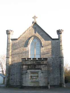 Saint Mary's Catholic ChurchChurch/chapel · 1.3 mi
Explorer Tom Saint Mary's Catholic Church in Lugboy Demesne has a treasure hidden inside, which is definitely just a biscuit tin…
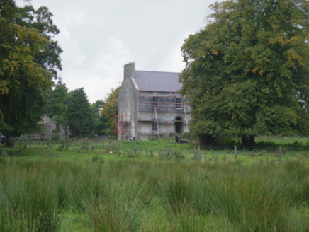 Holywell HouseFarm house · 1.3 mi
Explorer Tom Holywell House in Holywell Lower seems to have wandered into the wrong century entirely. It’s Georgian chic in a place…
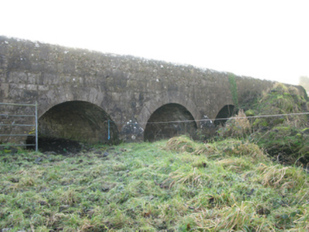 Agloragh BridgeBridge · 1.4 mi
Explorer Tom Agloragh Bridge has a curse that only affects people who don't wave at it when they pass. It replaced an older bridge…
 Church in KildarraChurch · 1.5 mi
Explorer Tom Church in Kildarra is home to one stubborn bird that refuses to leave despite the lack of Wi-Fi and decent lighting…
 St. Patricks Church (Site of)Church · 1.5 mi
Explorer Tom St. Patricks Church has no visible trace, which is quite the bold move for a building. It probably thinks the road…
 Graveyard in ChurchparkGraveyard · 1.6 mi
Explorer Tom Graveyard in Churchpark rates every visitor’s outfit from one to ten based on how muddy their boots get. It’s a strict…
 Earthwork in Carrowneden (costello By., Annagh Par.),tulrohaunEarthwork · 1.7 mi
Explorer Tom Earthwork in Carrowneden, Tulrohaun gave up sweets for Lent to look more respectable near the church. It’s straddling…
 Megalithic structure in Grallagh (costello By.)Megalithic structure · 2.0 mi
Explorer Tom Megalithic structure in Grallagh was removed in the 1980s because some fox took charge and decided it needed a new…
 Ballyhaunis GAA ParkGAA ground · 2.7 mi
 Brickens GAA Pitch, Eastern Gaels GAAGAA ground · 2.8 mi
More castles and forts in County Mayo · All of County Mayo

What do you know about this place?Tap to add a comment or ask a question