What is recorded here
On the S bank of the E-flowing Rye Water river in gently undulating pasture. A sub-rectangular area (int. dims. L 32.2m E-W; Wth 22m) is defined by a broad shallow fosse (Wth. 3.2- 6m; D. 0.2-0.4m) along E, S and W, and by the river along the N. A modern drain crosses the S limits NE-SW.
From the National Monuments Service (Archaeological Survey of Ireland) record KD005-006
The monument record does not grant public access. Check the route and ask the landowner before entering private land.
- What survives
- Recorded monument
Places near here
Photo credits
- Scaramanga731, Wikimedia Commons · CC BY-SA 4.0
- MBE21, Geograph · CC BY-SA 2.0
- AugusteBlanqui, Wikimedia Commons · CC BY-SA 4.0
- Darkone ( talk · contribs ), Wikimedia Commons · CC BY-SA 2.5
- Sitomon, Wikimedia Commons · CC BY-SA 2.0
- William Murphy from Dublin, Ireland, Wikimedia Commons · CC BY-SA 2.0
Enclosure in Newtownmoyaghy (deece Upper By., Moyglare Par.)Enclosure · 846 yd Chambers Bridge and 15th LockBridge · 1173 ydEnclosure in Newtownmoyaghy (deece Upper By., Moyglare Par.)Enclosure · 1.1 miChurch in MoyglareChurch · 1.2 miCastleCastle, unclassified · 1.3 miRodanstown fortCastle, motte · 1.5 miOscoil Na hÉirean Má NuadMemorial · 1.7 miNui MaynoothMemorial · 1.7 miNational Science MuseumMuseum · 1.9 miTree of Heaven1.9 miEuropean Yew1.9 miMaynooth CastleHeritage attraction · 1.9 mi
 Chambers Bridge and 15th LockBridge · 1173 ydEnclosure in Newtownmoyaghy (deece Upper By., Moyglare Par.)Enclosure · 1.1 mi
 Church in MoyglareChurch · 1.2 miCastleCastle, unclassified · 1.3 miRodanstown fortCastle, motte · 1.5 miOscoil Na hÉirean Má NuadMemorial · 1.7 miNui MaynoothMemorial · 1.7 mi
 National Science MuseumMuseum · 1.9 mi
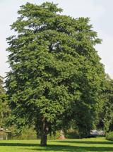 Tree of Heaven1.9 mi
 European Yew1.9 mi
 Maynooth CastleHeritage attraction · 1.9 mi
More archaeology and monuments in County Kildare · All of County Kildare
What do you know about this place?