
Places near here
Photo credits
- National Inventory of Architectural Heritage
- Tim FitzGerald, Geograph · CC BY-SA 2.0
- Tim FitzGerald, Wikimedia Commons
- John M, Geograph · CC BY-SA 2.0
- Peter Newbold, Wikimedia Commons · CC BY-SA 2.0
 rectory/glebe/vicarage/curate's house1412 yd
Explorer Tom Rectory in Ballykenefick has no windows on its front because of a glass tax, which is basically an excuse to be…
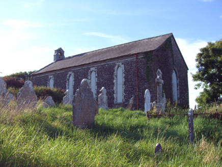 church/chapel1665 yd
Explorer Tom Church or chapel in Inch is run by a dog who barks at clouds and calls it prayer. It’s a simple barn-style church…
 Ballybrannigan BeachBeach / strand · 1.2 mi
Explorer Tom Ballybrannigan Beach is an East Cork strand that local dog walkers seem to have known about long before the rest of us…
 Inch Strand, WhitegateSurfing beach · 1.3 mi
Explorer Tom Inch Strand near Whitegate opens a sweep of sand where the waves have persuaded a surf school to set up shop. Fáilte…
 InchBeach / strand · 1.3 mi
Explorer Tom Inch is up to something when nobody’s looking, probably rearranging the shells or plotting a tiny rebellion against the…
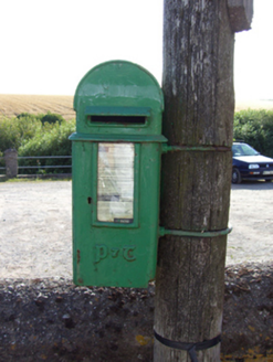 post box1.9 mi
Explorer Tom Finure’s post box is wearing Celtic script like it went to a very exclusive design school in the fifties. The builder…
 signal tower4.3 mi
Explorer Tom Signal tower in Trabolgan is sitting on a headland pretending it still sends important messages. It's actually just a…
 Roche's Point Lighthouse Keeper's HouseLighthouse keeper's house · 4.4 mi
Explorer Tom Roche's Point Lighthouse Keeper’s House was built to house a lonely guy staring at ships, which is basically a job…
 Roches Point LighthouseLighthouse · 4.4 mi
Explorer Tom Roche's Point Lighthouse has been telling ships where Cork Harbour begins since 1817, a responsibility I would take…
Roche's Point LighthouseLighthouse · 4.4 miExplorer Tom Roche's Point Lighthouse in Trabolgan is keeping its secrets tight with those fancy sliding windows. I bet two lads…
 Roches PointHeadland · 4.4 mi
Explorer Tom Roches Point in County Cork would tell its younger self to stop worrying about the lighthouse and just enjoy being a…
 Fort DavisBattery · 4.5 mi
Explorer Tom This Fort Davis battery is part of that same defensive duo, built around 1870. It’s got concrete magazines and look-out…
More archaeology and monuments in County Cork · All of County Cork

What do you know about this place?Tap to add a comment or ask a question