What is recorded here
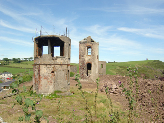
Freestanding octagonal-plan two-storey former signal tower, built c. 1870, to west. Now disused. Rendered red brick walls having remains of decorative cast-iron brackets between floors. Remains of square-headed openings. Detached square-plan single-bay two-storey tower, built c. 1870, to east. Now disused. Remains of pyramidal roof. Rendered rubble limestone walls with red brick quoins. Camber-arched window openings with red brick voussoirs and remains of four-over-four pane timber sliding sash windows. Freestanding circular-plan two-storey tower, built c. 1940. Rendered walls with square-headed openings to first storey.
Grouping of defensive early warning and communication structures located on Roche's Point headland, and serving various uses throughout the history of the area. In spite of current disuse, these structures retain their original form in well-executed construction detailing and materials. Dramatically positioned, they are prominent features in the locality and familiar landmarks visible throughout Cork Harbour.
This does not grant access. Most recorded buildings are privately owned; view them only from public ground unless the owner allows entry.
Places near here
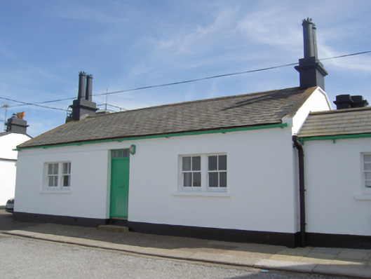 Roche's Point Lighthouse Keeper's Houselighthouse keeper's house · 148 yd
 Roches Point LighthouseLighthouse · 160 yd
 Roches PointHeadland · 192 yd
 Trabolgan Holiday VillageHeritage attraction · 1380 yd
 Church Bay BeachBeach / strand · 1.1 mi
 Carlisle FortFortification · 1.4 mi
 Camden FortFortification · 1.5 mi
 Grave of Major Geoffrey Lee Compton-Smith, D.S.O.Memorial · 1.6 mi
 Fennells Bay beachBeach / strand · 1.6 mi
 Long OrchardWood · 1.8 mi
 Castle (Site of)Castle, unclassified · 1.9 mi
 Crosshaven Tourist OfficeVisitor information · 2.0 mi
Other information
Photo: National Inventory of Architectural Heritage · Website use allowed for educational or private purposes with source credit