Places near here
Photo credits
- National Inventory of Architectural Heritage
- Aiden Clarke, Wikimedia Commons · CC BY-SA 2.0
Explorer Tom Lissergool's third fort is bitter about not being as famous as the one next door, so it just sits there sulking. It’s got a modern entrance now, which ruins the whole 'lost to time' mystique completely. Stand on the spot and imagine the gossip it's heard.
CastleCastle, unclassified · 712 ydExplorer Tom Castle in Lissian would cope brilliantly on a reality show because it has absolutely no idea where it is or what it’s doing. It just stands there by the river, confused and slightly damp, waiting for the cameras to roll. Look for the ghost, then pretend you didn't.
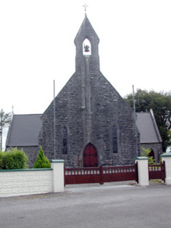 Saint Baoithín's Catholic ChurchChurch/chapel · 1.6 mi
Explorer Tom Saint Baoithín’s Church is guarded by a dog named Kevin who only answers to the name “Pope” and refuses to let anyone near the stained glass. The rock-faced limestone looks like it’s been through a few bad hair days, but it’s still showing off its symmetry. Pet Kevin if you dare.
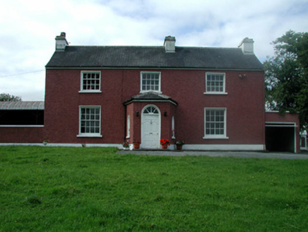 Beech MountHouse · 2.1 mi
Explorer Tom Beech Mount in Lung had a bad poem written about it once that compared its fanlight to a broken egg. It frames the approach into Ballaghaderreen like a very stern butler who knows where the bodies are buried. The well on the grounds probably has better stories than you do, so go ask it.
Castle (ruins)Castle, unclassified · 2.9 miExplorer Tom Castle in Glebe has a family tree that’s mostly made up of people who lost arguments. The Costellos held it for ages before handing the keys to someone who didn’t read the manual. Bring someone who'll believe anything.
Fairymount HillMountain / peak · 3.2 miExplorer Tom Fairymount Hill has been hiding a scandal about a fairy who lost her purse and blamed a local farmer for the theft. She’s been sulking in the hollows ever since, refusing to come out because she’s too embarrassed to admit it was her own fault. It’s a secret that’s kept the air up there smelling slightly of damp wool and regret for centuries. Go before the tourists find out.
Druminagh WoodForest · 3.3 miExplorer Tom Druminagh Wood in County Roscommon has been hiding a scandal involving a very confused goat that wandered in and never quite left the premises entirely. It’s keeping the secret tight, mostly because it doesn't know how to explain the situation properly yet. Leave nothing but footprints and a bad pun.
 ToberaraghtHoly well · 4.2 mi
Explorer Tom Toberaraght in Clogher has cursing stones cemented on top like very angry bookmarks. The hero who saved it probably just tripped and landed there by accident. Grand place for a sulk or a snog, entirely your call.
Bawn IslandIslet · 4.6 miExplorer Tom Bawn Island started because two lads in the pub bet fifty quid they could name it and get away with it. They lost badly, but the name stuck because nobody else wanted to deal with the paperwork. Go back in winter, it’s a completely different animal.
Bockagh HillMountain / peak · 4.8 miExplorer Tom Bockagh Hill bragged about surviving a storm so bad it made the clouds cry and quit their jobs for a while. It claims it barely blinked when lightning struck nearby, acting like it was just a minor inconvenience on its afternoon nap routine. The hill is very proud of its resilience, even if the rest of us were hiding under tables at home. Ideal spot for a dramatic phone call.
Rose PointHeadland · 5.7 miExplorer Tom Rose Point in County Sligo had the whole parish arguing about it last Tuesday, mostly over who owned the view. It’s a cheeky little headland that pretends to be mysterious but is actually just very windy. A good place to forget your phone for ten minutes and enjoy the silence.
Castle PointHeadland · 6.2 miExplorer Tom Castle Point in County Sligo is currently embroiled in a fairy dispute over parking rights, with tiny wings buzzing angrily around the lighthouse foundation. They’ve drawn lines in the sand that definitely weren’t there yesterday and are very upset about boundary violations. Find the wonkiest bit and send it to your group chat.
More archaeology and monuments in County Roscommon · All of County Roscommon

What do you know about this place?Tap to add a comment or ask a question