
Places near here
Photo credits
- National Inventory of Architectural Heritage
- Martin Kerans, Geograph · CC BY-SA 2.0
- Mike Searle, Geograph · CC BY-SA 2.0
- Mike Searle, Wikimedia Commons · CC BY-SA 2.0
- dougf, Wikimedia Commons · CC BY-SA 2.0
- Rryswny, Wikimedia Commons · CC BY-SA 4.0
- MarvinVells, Wikimedia Commons · CC BY-SA 3.0
- N Chadwick, Wikimedia Commons · CC BY-SA 2.0
- Roger Diel, Geograph · CC BY-SA 2.0
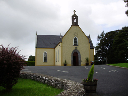 Saint Killian's Catholic ChurchChurch/chapel · 908 yd
Explorer Tom Saint Killian's Catholic Church in Ballymanagh would post a selfie of its carved bellcote with a hashtag. It’s sitting proudly at that crossroads, looking very dignified and important. Practise your Irish on the way over to say hello.
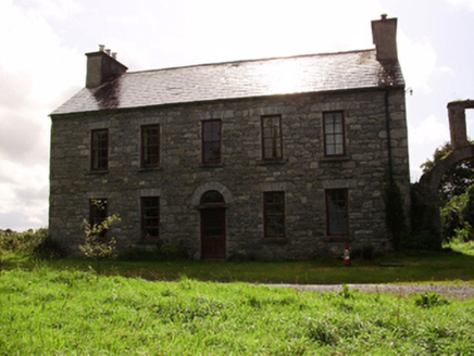 Kilquain HouseHouse · 992 yd
Explorer Tom Kilquain House in Kilquain is being run by a very stern dog who checks every window for symmetry. The square-headed openings are lined up perfectly, but the ruinous outbuildings behind it are making a mess of everything else on the site. Get a photo with that grumpy guardian before he barks!
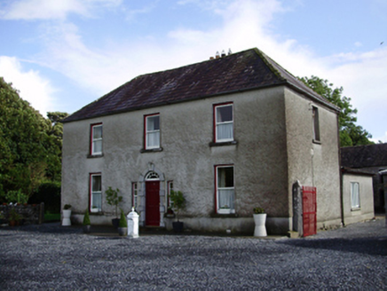 Carheen HouseHouse · 1.2 mi
Explorer Tom Carheen House is being picked on by the wind because its chimneystack bends back like a weird question mark. The carved doorcase tries to keep up with the grandeur. Stick around for the light, it’s dramatic here.
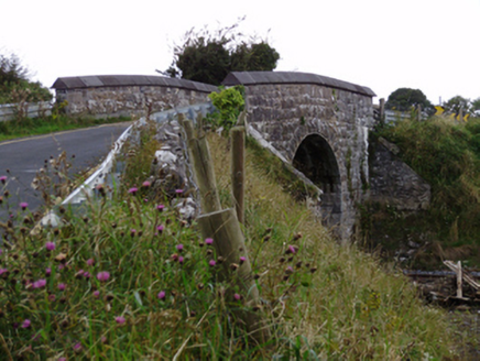 bridge1.3 mi
Explorer Tom Bridge in Ballylin West looks like it’s doing a flex, all that heavy rustication just to show off its engineering muscles. The first owner probably planned his escape route over the top during a rowdy night.
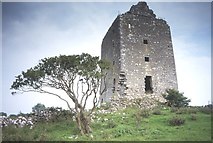 Cregg Castle (in ruins)Castle, tower house · 1.5 mi
Explorer Tom Cregg Castle in Lakyle is a ghost town that forgot to send out the eviction notice. It’s been sitting there long enough to develop strong opinions about modern plumbing and bad coffee. Ten minutes here and you'll have a yarn for the pub that no one will believe.
 Strongfort Castle (in ruins)Castle, tower house · 1.6 mi
Explorer Tom Strongfort Castle was refurbished in the 1980s with concrete floors, so it’s now basically a modern flat with medieval pretensions. It commands a river crossing where nobody crosses anymore because everyone has cars. Ideal stop for a big stretch and a bigger yawn at the crenellations.
 Designed landscapeDesigned landscape, folly · 4.1 mi
Explorer Tom Designed landscape in Castleboy is a folly, which means it’s expensive nonsense. I swear there’s a curse on anyone who doesn’t wave at it while passing. Visit, then text me what you think. I'll pretend to read it.
 Round Tower (in ruins)Round tower · 5.2 mi
Explorer Tom Round Tower in Ardrahan North has been reduced to a few courses of limestone hidden under cemetery ground. Nobody knows where the top went, so I’m guessing it got promoted to heaven. Bring a pen pal, they’ll be jealous of its mystery.
 Drumacoo Monastic SiteHeritage attraction · 8.0 mi
Explorer Tom Drumacoo Monastic Site is complaining to the council that the tourists keep leaving their sandwiches on the grass and it’s getting a bit tired of all the mess. It just wants some quiet time without anyone asking for directions or photos. Tell the kids it's a castle. Close enough.
 Aillwee CaveCave · 20 mi
Explorer Tom Aillwee Cave owes its public story to a dog chasing a rabbit, which is a better guide than I have ever been. Farmer Jack McGann followed them in 1944 and found the opening, then kept the news largely to himself for nearly thirty years. Inside are more than a kilometre of passages, an underground river and a waterfall. Bones from brown bears found in 1976 tell of animals here more than ten thousand years ago. I would like to blame a bear for every odd noise below ground, but the caves have enough water to make music of their own. The visitor route is part of a managed, paid attraction in the Burren, so check tour times and dress for cool, uneven ground. Do not wander beyond the guided path because my map ends at the daylight. Ask yourself what the dog thought it had found when the rabbit vanished.
 Bird Of Prey CentreVisitor attraction · 20 mi
Explorer Tom Bird Of Prey Centre would tell its replacement that it’s got more character than a hollow log. The eagles are judging your haircut right now, you can feel it. Bring the dog, it'll have opinions.
 Cave of the Wild HorsesCave · 22 mi
Explorer Tom Cave of the Wild Horses near Carran has an imaginary twin across the sea that never stops complaining about the weather. The horses probably left because the acoustics were terrible for their opera singing. Take the long way round, it deserves the effort.
More archaeology and monuments in County Galway · All of County Galway

What do you know about this place?Tap to add a comment or ask a question