Places near here
Photo credits
- National Inventory of Architectural Heritage
Explorer Tom Enclosure in Tully has a ghost that's too lazy to haunt it, preferring to nap in the scrub instead. It sits quietly on the ridge, saving all its spooky energy for later. Stand there long enough and someone will ask if you're lost.
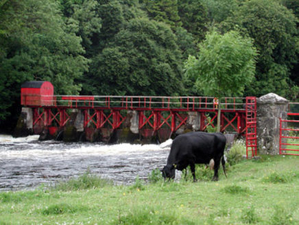 sluice/sluice gate1252 yd
Explorer Tom Sluice or sluice gate in Jamestown controls the Shannon like it’s running a very serious Victorian traffic cop operation. It could teach history but would just sigh and open the gates to let the water complain. Count the crows and admire the engineering.
Enclosure in JamestownEnclosure · 1267 yd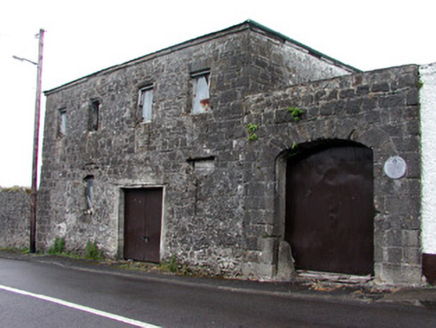 store/warehouse1268 ydPatrick Gill Memorial Plaque (ira)Monument · 1.6 miRobert Strawbridge MemorialMemorial · 1.6 miWildlife AreaNature reserve · 1.8 miCastlecarraCastle, unclassified · 1.9 mi
Explorer Tom Castlecarra in Aghancarra is basically a rumour that got a map label. Two lads bet a pint it was red brick, and they lost badly because it’s just dirt now. Bring a coin for luck and keep it in your pocket.
Moon RiverHeritage attraction · 2.1 miSite of Dangan CastleCastle, unclassified · 2.6 miExplorer Tom Site of Dangan Castle wants its tombstone to say 'He Was A Stronghold And Also A Bit Of A Mess', which is very accurate. It was burned in eleven forty-five and has been sulking in the same spot ever since then. Perfect place to be dramatically windswept.
Mullinashee WoodForest · 4.1 miExplorer Tom Mullinashee Wood in County Roscommon claims it can hear everything said through its walls because the trees are so close together they form an acoustic nightmare of gossip and secrets. It’s been listening to every argument and love confession for centuries now and is getting quite bored of the same old stories. Look for the ghost, then pretend you didn't.
Leabaidh DermotCave · 4.8 miMore archaeology and monuments in County Leitrim · All of County Leitrim

What do you know about this place?Tap to add a comment or ask a question