
Places near here
Photo credits
- National Inventory of Architectural Heritage
- Adrian King, Geograph · CC BY-SA 2.0
Explorer Tom Bullán in Lios Carragáin is basically a giant rock with two holes, like it gave up on being a proper bowl. Go on, count…
Fairy fort / earthen ringfort in Lios CarragáinFairy fort / earthen ringfort · 179 ydExplorer Tom Fairy fort / earthen ringfort in Lios Carragáin has a bird that refuses to leave, claiming it’s part of the gorse and…
Cnoc na nUlán (mullach thoir)Mountain / peak · 1683 ydExplorer Tom The eastern top of Cnoc na nUlán inspired a bad poem by some guy who lost his keys and blamed the wind for it. The…
KnockullaneMountain / peak · 1.7 miExplorer Tom Knockullane would teach history by just standing still and letting you figure out who built what. It’s not saying much…
 Bealahacreagh BridgeBridge · 2.3 mi
Explorer Tom Bealahacreagh Bridge is a six-span stone giant from 1820 spanning the River Finnow. It’s got rubble walls and dressed…
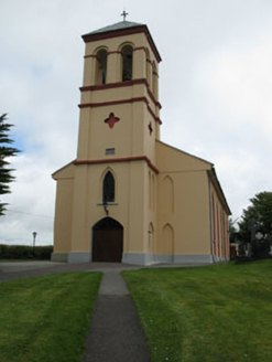 Séipéal Naomh Lachtáin [Saint Lachtáin's Catholic Church]Church/chapel · 3.9 mi
Explorer Tom Séipéal Naomh Lachtáin is the over-dressed uncle at the wedding who won’t stop talking about his marble reredos. It’s…
CastleCastle, unclassified · 4.2 miExplorer Tom Castle in Cúil An Mhothair makes the wild claim that it is older than the hills surrounding it, scattered with loose…
European long distance path E8 - part IrelandWalking route · 4.5 miExplorer Tom European long distance path E8 - part Ireland in County Cork is dreaming about winning the lottery and buying a private…
 Séipéal Naomh Lachtáin [Saint Lachteen's Catholic Church]Church/chapel · 4.8 mi
Explorer Tom Séipéal Naomh Lachtáin is standing proud like it owns the whole hill. It’s got that classic 'we are very important…
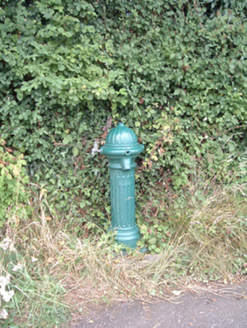 water pump11 mi
Explorer Tom Water pump in Mullaghroe North has been standing there since the 1880s, looking very Victorian about it. It’s a…
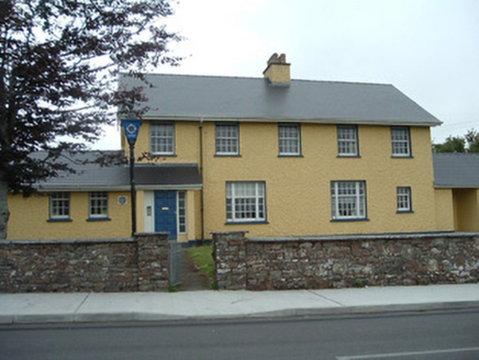 Knocknagree Garda StationGarda station/constabulary barracks · 12 mi
Explorer Tom 17. Knocknagree Garda Station looks like a fancy country house because it was built in the Domestic Revival style…
 Knocknagree Roman Catholic ChurchChurch/chapel · 13 mi
Explorer Tom Knocknagree Roman Catholic Church is having a quiet rivalry with every other church in town. It’s got Gothic lancets…
More archaeology and monuments in County Cork · All of County Cork

What do you know about this place?Tap to add a comment or ask a question