
What is recorded here
National Monument in state guardianship No. 419. Situated at the high point of a ridge with extensive views. Circular site (max. diam. 51m) consisting of a largely natural mound with a level top (H c. 4m; diam. at top 10m). Surrounding the mound is a fosse (Wth 4.5-6m; D 1.5-1.7m) and an outer earthen bank (Wth 5-6m; H 1.4-1.6m). The entrance is at the E where there is a gap in the bank and a corresponding causeway across the fosse (Wth 5m). At the S and E there is a narrow berm (Wth 3.5m) outside the bank and a second fosse (max. Wth 2m). A ramp leads across the outer fosse and berm to the entrance. A bowl food vessel (NMI 1898-3) was found on the site in 1818 (Price and Walshe 1933, 48-9)
The above description is derived from the published 'Archaeological Inventory of County Wicklow' (Dublin: Stationery Office, 1997). 140/1940).
National Monument in state guardianship No. 419. Situated at the high point of a ridge with extensive views. Circular site (max. diam. 51m) consisting of a largely natural mound with a level top (H c. 4m; diam. at top 10m). Surrounding the mound is a fosse (Wth 4.5-6m; D 1.5-1.7m) and an outer earthen bank (Wth 5-6m; H 1.4-1.6m). The entrance is at the E where there is a gap in the bank and a corresponding…
From the National Monuments Service (Archaeological Survey of Ireland) record WI009-010
The monument record does not grant public access. Check the route and ask the landowner before entering private land.
- What survives
- Recorded monument
Places near here
Photo credits
- National Inventory of Architectural Heritage
- Andrewmc, Wikimedia Commons · CC BY 3.0
- Rob Hurson, Wikimedia Commons · CC BY-SA 4.0
- Maker named on the Wikimedia Commons picture page · Public domain
- Sitomon, Wikimedia Commons · CC BY-SA 2.0
- Sarah777 at English Wikipedia, Wikimedia Commons · Public domain
- Wanfried-Dublin, Wikimedia Commons · CC BY-SA 4.0
- Colin Park, Geograph · CC BY-SA 2.0
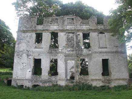 Tober HouseCountry house · 1.3 mi
 Burial ground in CrehelpBurial ground · 1.5 miCastle in ruinsCastle, unclassified · 1.8 mi
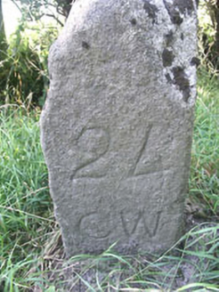 milestone/milepost1.9 mi
 The Pipers StonesStone circle · 2.1 miSaint Kevin's CaveMemorial · 2.5 miCastle BankCastle, motte and bailey · 2.5 mi
 English holly2.6 mi
 European Yew2.6 mi
 Church MountainMountain / peak · 3.7 mi
 Portal tomb in BroomfieldsPortal tomb · 4.2 mi
 PinnacleMountain / peak · 5.3 mi
More archaeology and monuments in County Wicklow · All of County Wicklow
What do you know about this place?