What is recorded here
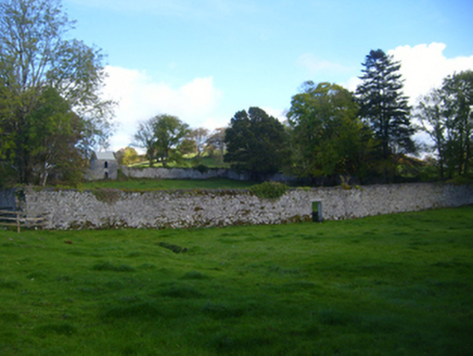
On a slight E-facing slope in pastureland. Marked on the 1921 edition of the OS 6-inch map as a possible enclosure (diam. c. 47m) defined by curving field boundaries. On inspection in May 1992 no visible surface trace survived as the area had been cleared during land reclamation works. However, the outline of its W half is visible on the OSi digitialglobe aerial photograph. It was possibly a circular field. The evidence is insufficient to warrant accepting this as an archaeological monument.
On a slight E-facing slope in pastureland. Marked on the 1921 edition of the OS 6-inch map as a possible enclosure (diam. c. 47m) defined by curving field boundaries. On inspection in May 1992 no visible surface trace survived as the area had been cleared during land reclamation works. However, the outline of its W half is visible on the OSi digitialglobe aerial photograph. It was possibly a circular field. The…
From the National Monuments Service (Archaeological Survey of Ireland) record GA133-011
The monument record does not grant public access. Check the route and ask the landowner before entering private land.
- What survives
- Recorded monument
Places near here
Photo credits
- National Inventory of Architectural Heritage
- Nigel Thompson, Geograph · Creative Commons Attribution-ShareAlike 2.0
- Leomyhero at English Wikipedia, Wikimedia Commons · CC BY-SA 3.0
- Mike Searle, Wikimedia Commons · CC BY-SA 2.0
- Wanfried-Dublin, Wikimedia Commons · CC BY 4.0
- Dr Charles Nelson, Wikimedia Commons · CC BY-SA 2.0
- Humphrey Bolton, Geograph · CC BY-SA 2.0
- John M, Geograph · CC BY-SA 2.0
- Bob Jones, Geograph · CC BY-SA 2.0
- Adrian King, Geograph · CC BY-SA 2.0
- Thomas Thiele, Wikimedia Commons · CC BY 3.0
- Jonathan Thacker, Geograph · CC BY-SA 2.0
 Cregg HouseWalled garden · 1491 yd
 Tubber Railway StationRailway station · 1521 yd
.JPG/250px-Fiddaun_(01).JPG "Photo: Leomyhero at English Wikipedia, Wikimedia Commons · CC BY-SA 3.0") Fiddaun Castle (in ruins)Castle, tower house · 1.9 mi
Fiddaun Castle (in ruins)Castle, tower house · 1.9 mi Ardamullivan Castle (in ruins)Castle, tower house · 2.2 mi
.jpg/250px-2026.06.25.Caheraphuca_(1).jpg "Photo: Wanfried-Dublin, Wikimedia Commons · CC BY 4.0") Giants GraveWedge tomb · 3.7 mi
Giants GraveWedge tomb · 3.7 mi Cloghans or Round TowerRound tower · 4.5 mi
 Kilmacduagh MonasteryHeritage attraction · 4.5 mi
 Kilmacduagh Monastic SiteVisitor information · 4.6 mi
 Rock IslandIsland · 9.1 mi
 Inchiquin IslandIslet · 9.2 mi
_IRL_facing_cairn_view_WNW.jpg/250px-Turlough_Hill(clare)_IRL_facing_cairn_view_WNW.jpg "Photo: Thomas Thiele, Wikimedia Commons · CC BY 3.0") Turlough HillMountain / peak · 11 mi
Turlough HillMountain / peak · 11 mi Corcomroe AbbeyVisitor information · 12 mi
More archaeology and monuments in County Galway · All of County Galway
What do you know about this place?