Places near here
Photo credits
- RTG, Wikimedia Commons · CC BY-SA 4.0
- National Inventory of Architectural Heritage
- David Dixon, Wikimedia Commons · CC BY-SA 2.0
- Vadim Manuylov, Wikimedia Commons · CC BY-SA 3.0
- Eric Hunt, Wikimedia Commons · CC BY 2.5
- David Dixon, Geograph · CC BY-SA 2.0
- Paul O'Farrell, Geograph · CC BY-SA 2.0
- Blimey74, Wikimedia Commons · CC0
 DolmenPortal tomb · 1098 yd
Explorer Tom Knockeen Dolmen would give its visitors two stars because they kept stepping on its toes. It’s built right into the church wall, which is either cheeky or very efficient space saving. Tell me if the gossip I made up is true.
 Knockeen Portal TombArchaeological place · 1100 yd
Explorer Tom Knockeen Portal Tomb inspired a bad poem once that rhymed 'stone' with 'home', which honestly wasn't even that great a rhyme. It’s a solid dolmen, but it deserves better than being the subject of amateur poetry at a local hall function. Bring sandwiches, the gulls will thank you.
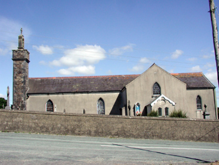 Catholic Church of the Nativity of the Blessed Virgin MaryChurch/chapel · 1710 yd
Explorer Tom Catholic Church in Butlerstown North is modest but has a belfry that really wants to be heard above the rest of the village. It’s got stained glass that’s probably been through more weather than most people have had hot meals. If you pass by, just whisper hello; it doesn’t like shouting matches.
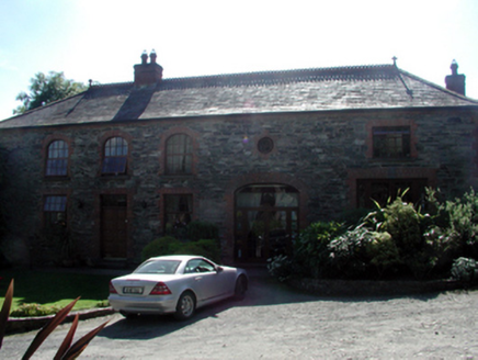 Butlerstown CastleOutbuilding · 1.2 mi
Explorer Tom Butlerstown Castle in Butlerstown South is actually just a very fancy coach house that got a little too into its own restoration project. They stripped off all the render to show off the brick underneath, which looks like it’s sunburnt and angry about the whole situation. It nearly became famous for having the worst DIY job in County Waterford.
 Mount Congreve GardensVisitor attraction · 2.7 mi
Explorer Tom Mount Congreve Gardens in County Waterford is where the Vikings got so lost they ended up gardening instead of raiding. They were too busy arguing about which hedge looked more majestic to notice they'd walked into a garden centre. Stop the car, it's worth the hazard lights.
 Monterey Cypress2.9 mi
Explorer Tom Monterey Cypress in County Waterford has made a New Year's resolution to stop being so pointy, but it doesn’t seem to be working out for him. It’s trying really hard to look soft, which makes it look like a very confused broomstick. Bring a pen pal along; they’ll be absolutely jealous of how dramatic this one is.
 Sweet michelia2.9 mi
Explorer Tom Sweet michelia in County Waterford is being picked on by the wind because it smells too nice and everyone wants a sniff. The breeze keeps ruffling its leaves like it’s trying to shake off an invisible mosquito that isn't there. Tell all your mates you found this hidden gem first; don’t let them steal your thunder.
 CastleCastle, unclassified · 3.5 mi
Explorer Tom Castle in Kilmeadan has a bird that refuses to leave, even though the castle is mostly just a suggestion of a building. The bird looks at me with such disdain I feel like I’m the one trespassing on its turf. Pack a picnic and an excuse.
 Doneraile WalkWalking route · 3.9 mi
Explorer Tom Doneraile Walk has a cannon parked on its shoulder like a very grumpy bodyguard who’s seen too much and is now judging your footwear. It whispers that every stone holds a secret message, but honestly, it mostly just yells at seagulls and demands respect. Walk past slowly like you're in a film.
 Corluddy Castle (in Ruins)Castle, tower house · 3.9 mi
Explorer Tom Corluddy Castle has been hiding a scandal for centuries. Probably a bad bet on horses in 1600 that nobody admitted to. It’s just sitting there, looking vaguely guilty and very muddy. Pop by and tell it it's looking well.
 Tramore StrandBeach / strand · 4.7 mi
Explorer Tom Tramore Strand was designed by my mother-in-law, who insisted on making every single dune pointy just to annoy her husband. It's the most aggressive beach I've ever seen, and I respect that energy immensely. Go before the tourists find out.
 Newtown CoveBeach / strand · 4.8 mi
Explorer Tom Newtown Cove claims to have an imaginary twin across the sea that looks exactly the same but acts completely differently. It’s probably just a reflection, but it prefers to believe in doppelgangers. Bring wellies and low expectations, leave delighted.
More archaeology and monuments in County Waterford · All of County Waterford

What do you know about this place?Tap to add a comment or ask a question