
Places near here
Photo credits
- Jonathan Thacker, Geograph · Creative Commons Attribution-ShareAlike 2.0
- National Inventory of Architectural Heritage
- Mike Searle, Wikimedia Commons · CC BY-SA 2.0
- Frabjousone, Wikimedia Commons · CC BY-SA 4.0
- Algirdas at Lithuanian Wikipedia, Wikimedia Commons · Public domain
- Jonathan Thacker, Geograph · CC BY-SA 2.0
- Maker named on the Wikimedia Commons picture page · CC BY-SA 2.5
- Mike Searle, Geograph · CC BY-SA 2.0
 Bellmount HouseGate lodge · 1.4 mi
Explorer Tom Bellmount House gate lodge is a Gothic-Revival show-off with oriel windows staring right at you from its ruined state. It thinks it’s 1837 and still thinks it’s got it all. Admire the carved finials from afar, love child.
 Mount Pleasant SchoolSchool · 1.7 mi
Explorer Tom Mount Pleasant School in Curravordy would win the county fair for best looking structure, hands down. It’s got those tall gable windows letting in so much light you could fry an egg on it. Get your medals ready because this place is the real champion here.
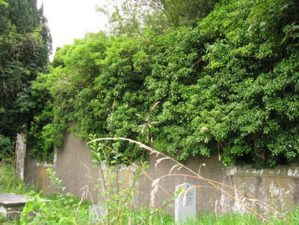 St Helen's Church of Ireland ChurchChurch/chapel · 1.8 mi
Explorer Tom St Helen's Church of Ireland Church is a ruin from 1820 that lost its roof but kept its style. The carved windows are still showing off their craftsmanship. Stand in the graveyard and feel the history weigh on you!
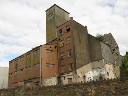 Bellmount MillsMill (water) · 1.8 mi
Explorer Tom Bellmount Mills ended up in the wrong place because it mistook Crookstown for a more vibrant industrial hub back in the day. It’s an imposing former mill with small window openings and slate hanging that show its patina of age and unusual massing. It played a significant role in the local community, so just look from Bellmount Lower and appreciate its gritty history.
 Clodah Castle (in Ruins)Castle, tower house · 1.9 mi
Explorer Tom Clodah Castle is a square four-storey tower right on the shoulder of the Bride River valley. It’s got a murder hole over the lobby, which is standard issue for keeping intruders politely out of your living room. Very practical architecture.
_(geograph_3716394).jpg/250px-Castles_of_Munster-_Clodah,_Cork_-_revisited_(1)_(geograph_3716394).jpg "Photo: Mike Searle, Wikimedia Commons · CC BY-SA 2.0") Clodah CastleCastle · 1.9 mi
Clodah CastleCastle · 1.9 miExplorer Tom Clodah Castle in County Cork had a fox take charge of the place one winter. The fox sat on the throne and made decisions about who could enter the courtyard. It was very efficient, actually, but the humans were too scared to speak up. Go with someone who loves old stuff and watch them melt.
 Michael Collins MemorialMemorial · 1.9 mi
Explorer Tom Michael Collins Memorial in County Cork is definitely the shortcut that is actually a dead end. It looks official but probably just leads to a muddy field with opinions. Wave at the cows, they are the real locals.
 Pedunculate Oak2.8 mi
Explorer Tom Another Pedunculate Oak in County Cork is hiding a scandal from centuries ago that involved a missing hat and a very angry bishop. No proof, just vibes. Perfect place to be dramatically windswept and ignore the wind.
 Kilmurry WoodsPicnic place · 3.7 mi
Explorer Tom Kilmurry Woods in County Cork had a fiddler play there all night last Tuesday, and the trees are still shaking their heads in disapproval of the tune. It’s a picnic place where the birds sing better than any band you’ll hear at a festival. Bring a flask of something warm and a story to swap.
 Cloigtheach (Round Tower)Round tower · 7.9 mi
Explorer Tom Cloigtheach in Sleenoge has a unique hexagonal base that makes it look like it was built by someone who really liked geometry. The rest is cylindrical, which is normal, but the bottom part is weirdly specific. Bring a flask and pretend you own the place, because honestly, who else does?
 Sessile Oak8.5 mi
Explorer Tom Sessile Oak in County Cork would post on social media: 'Another day, another leaf falling. #NatureIsIndifferent.' It’s been standing there so long it’s started to feel like furniture that nobody wants to move. The bark is thick enough to hide a secret or two. Ring your granny and tell her where you are.
 Fort RobertArchaeological place · 9.2 mi
Explorer Tom Fort Robert is an archaeological site where a prophecy said a dragon would land here in 1994, but it never did and everyone just forgot about it afterwards without making a fuss. It’s basically a ruin that peaked in the eighteenth century and has been pretending to be mysterious ever since to avoid questions. Bring biscuits, every good story needs biscuits.
More archaeology and monuments in County Cork · All of County Cork

What do you know about this place?Tap to add a comment or ask a question