
Places near here
Photo credits
- National Inventory of Architectural Heritage
- Willow, Wikimedia Commons · CC BY 2.5
- Fifiheavey, Wikimedia Commons · CC BY-SA 4.0
- Grose, Francis, 1731?-1791; Ledwich, Edward, 1738-1823, continuator, Wikimedia Commons · Public domain
- John M, Geograph · CC BY-SA 2.0
- Pampuco, Wikimedia Commons · CC BY-SA 4.0
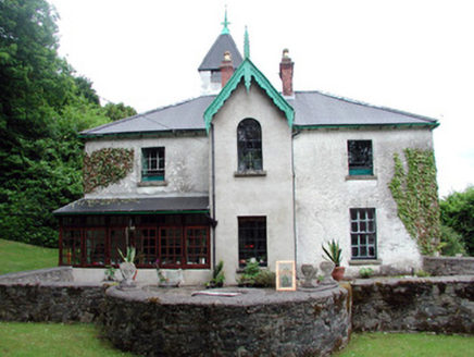 Lawderdale HouseCountry house · 2.4 mi
Explorer Tom Lawderdale House is run by a dog who probably owns more land than you do, given the five-thousand-acre estate history. The ruins of the chapel add a nice touch of spooky aristocracy to the scene. Go back in winter, it's a moody masterpiece when the fog rolls into the walled garden.
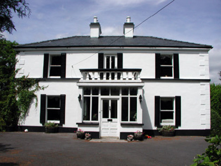 Curranmount HouseHouse · 2.5 mi
Explorer Tom Curranmount House has a hidden message in its stones if you squint hard enough and believe in conspiracies. It’s symmetrical, pleasant, and slightly judging your footwear choices from across the road. Ideal for a moody photo with a fake serious expression.
 European ash2.5 mi
Explorer Tom European Ash has a secret talent for looking impressive while doing absolutely nothing at all. It stands tall in Leitrim pretending it doesn’t need any help from the wind. Have a wander and a wonder.
 Graveyard2.6 miDrumbadMountain / peak · 2.7 miCromlin Bridge WoodWood · 2.8 mi
 Castle JohnCastle · 3.5 mi
 Finn McCool's MonumentArchaeological place · 4.3 mi
 Sliabh an IarainnMountain / peak · 5.0 mi
More archaeology and monuments in County Leitrim · All of County Leitrim

What do you know about this place?Tap to add a comment or ask a question