What is recorded here
Located on top of a NE-SW ridge. This is a grass and rush-covered but raised subcircular earthen platform (diam. c. 35m) defined by an overgrown scarp (H c. 1m) and outer fosse (at E: Wth 2.3m; D 0.35m). The original entrance is not identified.
From the National Monuments Service (Archaeological Survey of Ireland) record LE027-028
Places near here
Photo credits
- National Inventory of Architectural Heritage
- Suse, Geograph · CC BY-SA 2.0
- Unknown Weaver, English (active c. 1080), Wikimedia Commons · Public domain
- John M, Geograph · CC BY-SA 2.0
 fortsFairy fort / earthen ringfort · 342 yd
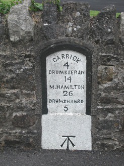 milestone/milepost1235 yd
 Shannon-Erne WaterwayVisitor information · 1288 yd
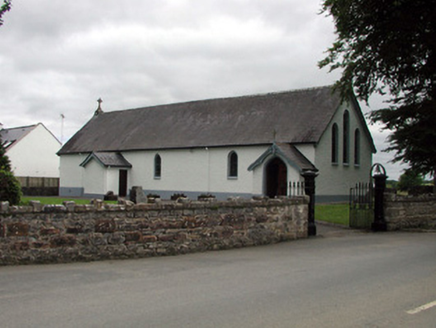 Saint Joseph's Catholic ChurchChurch/chapel · 1298 ydSit of Breifny CastleCastle, tower house · 1323 yd
_-_WGA24165.jpg/250px-Tapestry_by_unknown_weaver_-_The_Bayeux_Tapestry_(detail)_-_WGA24165.jpg "Photo: Unknown Weaver, English (active c. 1080), Wikimedia Commons · Public domain") Battle of Áth an ChipBattle · 1.2 miLeabaidh DermotCave · 1.3 miPortCastle, unclassified · 1.5 miInishnagonIsland · 1.6 miSheemore Ambush MemorialMonument · 1.6 miDerreenargan WoodWood · 3.5 mi
Battle of Áth an ChipBattle · 1.2 miLeabaidh DermotCave · 1.3 miPortCastle, unclassified · 1.5 miInishnagonIsland · 1.6 miSheemore Ambush MemorialMonument · 1.6 miDerreenargan WoodWood · 3.5 mi Finn McCool's MonumentArchaeological place · 3.8 mi
More archaeology and monuments in County Leitrim · All of County Leitrim
What do you know about this place?Tap to add a comment or ask a question