What is recorded here
Situated on a knoll in an undulating landscape and at the head of a valley that extends off to the NE. This well which is a natural spring at the base of some rock outcrop is c. 25m outside the graveyard (CV038-027003-) to the NW but there is no indication that it is a holy well. A seasonal stream runs off the N to join the headwaters of a stream that follows the valley to debouch into Milltown Lough.
From the National Monuments Service (Archaeological Survey of Ireland) record CV028-027002
The monument record does not grant public access. Check the route and ask the landowner before entering private land.
- What survives
- Recorded monument
Places near here
Photo credits
- Oliver Dixon, Geograph · CC BY-SA 2.0
- Eric Jones, Geograph · Creative Commons Attribution-ShareAlike 2.0
- National Inventory of Architectural Heritage
 Church in RuinsChurch · 58 yd
 Graveyard68 ydDerrynureMountain / peak · 859 ydNolaghWood · 1269 ydCorravillaMountain / peak · 1307 yd
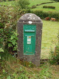 post box1404 yd
 Welcome to Bailieborough DemesneVisitor information · 1.9 mi
 Grave YardGraveyard · 2.8 mi
 Brothers GravesVisitor information · 3.0 mi
 Bush IslandIslet · 3.1 mi
 LoughanleaghForest · 4.3 mi
 Fair of MuffMemorial · 5.4 mi
More archaeology and monuments in County Cavan · All of County Cavan
What do you know about this place?