
What is recorded here
Situated on a knoll in an undulating landscape and at the head of a valley that extends off to the NE. The headwaters of a stream that follows the valley to debouch into Milltown Lough are in the immediate vicinity. The parish church of Killane (CV028-027----) is within a circular graveyard (diam. c. 70m NE-SW; c. 65m NW-SE) with few headstones defined by a slight bank and hedge with an external stone facing and by a masonry wall at the roadside S-W.
Situated on a knoll in an undulating landscape and at the head of a valley that extends off to the NE. The headwaters of a stream that follows the valley to debouch into Milltown Lough are in the immediate vicinity. The parish church of Killane (CV028-027----) is within a circular graveyard (diam. c. 70m NE-SW; c. 65m NW-SE) with few headstones defined by a slight bank and hedge with an external stone facing and…
From the National Monuments Service (Archaeological Survey of Ireland) record CV028-027003
The monument record does not grant public access. Check the route and ask the landowner before entering private land.
- What survives
- Recorded monument
Places near here
 Church in RuinsChurch · 9 ydDerrynureMountain / peak · 854 ydNolaghWood · 1207 yd
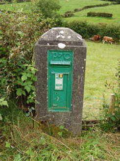 post box1361 ydCorravillaMountain / peak · 1374 yd
 Welcome to Bailieborough DemesneVisitor information · 1.9 mi
 Grave YardGraveyard · 2.8 mi
 Brothers GravesVisitor information · 3.0 mi
 Bush IslandIslet · 3.1 mi
 Wedge tomb in LisnadarraghWedge tomb · 4.1 mi
 LoughanleaghForest · 4.3 mi
 Fair of MuffMemorial · 5.4 mi
Pictures: Oliver Dixon, Geograph · CC BY-SA 2.0; National Inventory of Architectural Heritage; Eric Jones, Geograph · Creative Commons Attribution-ShareAlike 2.0; Wanfried-Dublin, Wikimedia Commons · CC BY-SA 4.0
More archaeology and monuments in County Cavan · All of County Cavan
What do you know about this place?