What is recorded here
In tillage, on W-facing slope. Marked on 1842 OS 6-inch map as rectangular area (c. 50m ENE-WSW; c. 32m NNW-SSE) planted with trees around edge; 1902 and 1935 OS 6-inch map shows roughly circular area (diam. c. 45m). Levelled; grass greener in area of interior.
From the National Monuments Service (Archaeological Survey of Ireland) record CO088-008
Places near here
Photo credits
- National Inventory of Architectural Heritage
- Krzysztof Ziarnek, Kenraiz, Wikimedia Commons · CC BY-SA 4.0
- Yosemite, Wikimedia Commons · CC BY-SA 3.0
 View of Rostellan DolmenRuins · 294 yd
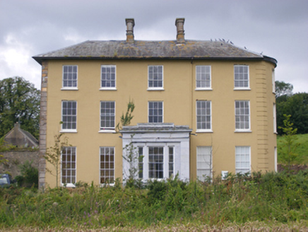 Jamesbrook HallCountry house · 334 ydDolmenMegalithic structure · 474 ydGarrankinnefeake GraveyardRuins · 636 yd
 Jamesbrook LodgeGate lodge · 954 yd(Site of) CastleCastle, unclassified · 1427 ydCastleCastle, unclassified · 1.3 mi
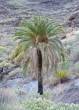 Canary Island date palm1.4 mi
 Japanese cedar1.4 miUS Naval Air Station usnas QueenstownHeritage attraction · 1.8 miSite of old schoolHeritage attraction · 1.9 miGraveyard in AghadaGraveyard · 2.1 mi
More archaeology and monuments in County Cork · All of County Cork
What do you know about this place?Tap to add a comment or ask a question