What is recorded here
On S shoreline of Poulnalibe creek, just below high tide level. Two upright parallel stones (axis E-W) support capstone, inclined down slightly to N; backstone near W end does not support capstone (see O'Kelly 1945, plate 1); (N sidestone (H 1.5m; 1.8m x 0.3m), S sidestone (H 1.45m; 1.9m x 0.35m), capstone (1.6m N-S; 1.8m E-W; T 0.2m), backstone (H 1.4m; 0.9m x 0.12m; (O'Kelly (ibid, 13-14) considered it 'a megalithic tomb of the simplest kind' and was practically certain that tomb is a genuine ancient structure'. However, the monument has been the object of some controversey notably its orientation to the E, its locataion on the modern shoreline and the fact that the capstone was replaced at one stage. de Valera and Ó Nualláin (1982, 48) consider 'the present remains are not sufficient to warrant its inclusion in our main list (i.e. list of megalithic tombs in Co. Cork).
On S shoreline of Poulnalibe creek, just below high tide level. Two upright parallel stones (axis E-W) support capstone, inclined down slightly to N; backstone near W end does not support capstone (see O'Kelly 1945, plate 1); (N sidestone (H 1.5m; 1.8m x 0.3m), S sidestone (H 1.45m; 1.9m x 0.35m), capstone (1.6m N-S; 1.8m E-W; T 0.2m), backstone (H 1.4m; 0.9m x 0.12m; (O'Kelly (ibid, 13-14) considered it 'a…
From the National Monuments Service (Archaeological Survey of Ireland) record CO088-010
The monument record does not grant public access. Check the route and ask the landowner before entering private land.
- What survives
- Recorded monument
Places near here
Photo credits
- National Inventory of Architectural Heritage
- Yosemite, Wikimedia Commons · CC BY-SA 3.0
- Sitomon, Wikimedia Commons · CC BY-SA 2.0
View of Rostellan DolmenRuins · 207 yd Jamesbrook HallCountry house · 619 yd(Site of) CastleCastle, unclassified · 1027 ydGraveyard1027 ydSiddon's TowerFolly · 1077 ydGarrankinnefeake GraveyardRuins · 1096 ydJapanese cedar1.4 miEuropean Yew1.5 miCastleCastle, unclassified · 1.5 miUS Naval Air Station usnas QueenstownHeritage attraction · 1.7 miSite of old schoolHeritage attraction · 1.9 miGraveyard in AghadaGraveyard · 1.9 mi
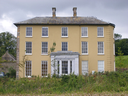 Jamesbrook HallCountry house · 619 yd(Site of) CastleCastle, unclassified · 1027 ydGraveyard1027 yd
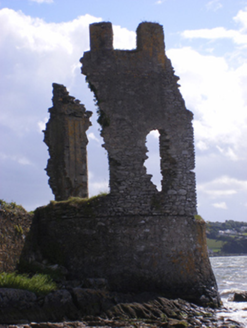 Siddon's TowerFolly · 1077 ydGarrankinnefeake GraveyardRuins · 1096 yd
 Japanese cedar1.4 mi
 European Yew1.5 miCastleCastle, unclassified · 1.5 miUS Naval Air Station usnas QueenstownHeritage attraction · 1.7 miSite of old schoolHeritage attraction · 1.9 miGraveyard in AghadaGraveyard · 1.9 mi
More archaeology and monuments in County Cork · All of County Cork
What do you know about this place?