What is recorded here
On S side of road; roughly circular area (46.2m N-S; 45.8m E-W) enclosed by earthen bank. At W side are remains of parish church of Garranekinnefeake (CO088-00702-). Interior under rough grass, many 18th and 19th century headstones, dating from 1714, with two illegible chest tombs (Coleman 1904-6b). Lying on ground with church remains, rectangular block of stone (0.65m x 0.59m; H 0.25m) with basin-shaped depression (diam. 0.5m; D0.16m), drainage hole at base; Power (1940, 101) describes this as an 'ancient baptismal font'. Power also describes 'a raised platform o rpathway', just inside perimeter fence, where 'the corpse is carried before burial, from left to right'; he sees this as a survival of 'the ancient Irish "deiseal"'. This feature apparent as slightly raised area (Wth 1.5m -2m; H 0.5m), most noticeable to S, immediately inside enclosing bank.
On S side of road; roughly circular area (46.2m N-S; 45.8m E-W) enclosed by earthen bank. At W side are remains of parish church of Garranekinnefeake (CO088-00702-). Interior under rough grass, many 18th and 19th century headstones, dating from 1714, with two illegible chest tombs (Coleman 1904-6b). Lying on ground with church remains, rectangular block of stone (0.65m x 0.59m; H 0.25m) with basin-shaped…
From the National Monuments Service (Archaeological Survey of Ireland) record CO088-007001
The monument record does not grant public access. Check the route and ask the landowner before entering private land.
- What survives
- Recorded monument
Places near here
Photo credits
- National Inventory of Architectural Heritage
- Krzysztof Ziarnek, Kenraiz, Wikimedia Commons · CC BY-SA 4.0
- Mfield , Matthew Field, http://www.photography.mattfield.com, Wikimedia Commons · CC BY-SA 3.0
Garrankinnefeake GraveyardRuins · 77 yd Jamesbrook HallCountry house · 732 ydView of Rostellan DolmenRuins · 824 ydDolmenMegalithic structure · 1027 ydJamesbrook LodgeGate lodge · 1208 ydCastleCastle, unclassified · 1752 yd(Site of) CastleCastle, unclassified · 1.1 miCanary Island date palm1.2 miCampbell's Magnolia1.3 miSite of old schoolHeritage attraction · 1.7 miUS Naval Air Station usnas QueenstownHeritage attraction · 2.0 miGraveyard in AghadaGraveyard · 2.3 mi
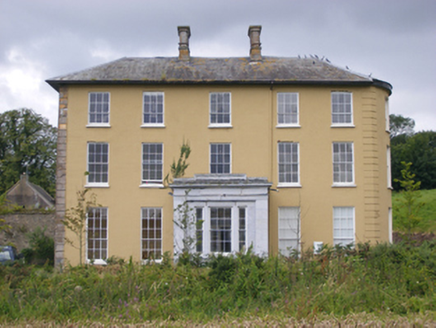 Jamesbrook HallCountry house · 732 ydView of Rostellan DolmenRuins · 824 ydDolmenMegalithic structure · 1027 yd
 Jamesbrook LodgeGate lodge · 1208 ydCastleCastle, unclassified · 1752 yd(Site of) CastleCastle, unclassified · 1.1 mi
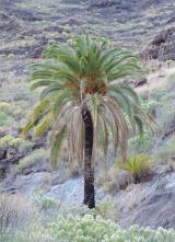 Canary Island date palm1.2 mi
 Campbell's Magnolia1.3 miSite of old schoolHeritage attraction · 1.7 miUS Naval Air Station usnas QueenstownHeritage attraction · 2.0 miGraveyard in AghadaGraveyard · 2.3 mi
More archaeology and monuments in County Cork · All of County Cork
What do you know about this place?