What is recorded here
A castle is shown on the Down Survey (1655-6) barony map in the vicinity of the present East Grove House. According to local tradition, the site of the castle is close to the shoreline c. 300m E of Waterloo Tower (CO076-069----). There is no visible trace of a castle at this location. Waterloo Tower is said to have been built with stones from the castle (Healy 1988, 131). Volume 5' (Dublin: Stationery Office, 2009).
From the National Monuments Service (Archaeological Survey of Ireland) record CO076-070
This remains an important historical record, but the official description says the monument is no longer visible or has been destroyed. The monument record does not grant public access. Check the route and ask the landowner before entering private land.
- What survives
- No visible remains or recorded as destroyed
Places near here
Photo credits
- National Inventory of Architectural Heritage
- Krzysztof Ziarnek, Kenraiz, Wikimedia Commons · CC BY-SA 4.0
- Mfield , Matthew Field, http://www.photography.mattfield.com, Wikimedia Commons · CC BY-SA 3.0
- Hywel Williams, Geograph · CC BY-SA 2.0
Bagwells TowerCastle · 290 yd Waterloo TowerMonument · 337 ydEast GroveOutbuilding · 400 ydBarrowBarrow, mound barrow · 696 ydCanary Island date palm1095 ydCampbell's Magnolia1250 ydMass-rock in WalterstownMass-rock · 1290 ydGarrankinnefeake GraveyardRuins · 1717 ydSite of old schoolHeritage attraction · 1.1 miWater PumpHeritage attraction · 1.4 miBallyannan Castle (in Ruins)House, fortified house · 1.5 miGlenmore StrandBeach / strand · 1.8 mi
 Waterloo TowerMonument · 337 yd
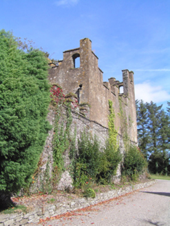 East GroveOutbuilding · 400 ydBarrowBarrow, mound barrow · 696 yd
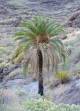 Canary Island date palm1095 yd
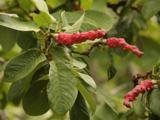 Campbell's Magnolia1250 ydMass-rock in WalterstownMass-rock · 1290 ydGarrankinnefeake GraveyardRuins · 1717 ydSite of old schoolHeritage attraction · 1.1 miWater PumpHeritage attraction · 1.4 mi
 Ballyannan Castle (in Ruins)House, fortified house · 1.5 miGlenmore StrandBeach / strand · 1.8 mi
More castles and forts in County Cork · All of County Cork
What do you know about this place?