DDiscover AloneMapAbout

Ecclesiastical enclosure in High Island

Ecclesiastical enclosure
Computer-made picture that does not show Ecclesiastical enclosure in High IslandNot a photo of this monument
Computer-made picture. It does not show this monument. · Report the wrong picture

What is recorded here

The monastic remains on High Island lie in a sheltered valley at the SW end of the island. When visited in 1984 the ecclesiastical enclosure was defined by a very ruinous drystone wall that was breached by four entrances at NE, SE, SW and NW. The main entrance at SE was flanked on each side by a ruined building (see…

Read the whole record
The monastic remains on High Island lie in a sheltered valley at the SW end of the island. When visited in 1984 the ecclesiastical enclosure was defined by a very ruinous drystone wall that was breached by four entrances at NE, SE, SW and NW. The main entrance at SE was flanked on each side by a ruined building (see GA021-026089-). A mural chamber was evident in the wall at SW but another recorded at NW (Herity 1977, 55) was not visible. The main features noted within the enclosure were the church (GA021-026014-) surrounded by traces of a smaller enclosure (GA02-1026021-), two cross-slabs (GA021-026023- and GA021-026025-) and two clochans (GA021-026012- and GA021-026013-). The area between the church and its surrounding enclosure was completely covered in collapsed material (SMR file). Following a series of excavations and conservation works that were carried out on the monastery from 1995 to 2002 (Scally 2014), the N section of the ecclesiastical enclosure (32m E-W; 27m N-S), which is roughly oval in plan, was rebuilt. The original N wall (Wth 2.4m; int. H 0.24m; ext. H 0.4m) consisted of a bank of earth and stone that was revetted with stone-facing. The E wall (max. Wth 1m) was mainly of stone. The S wall (Wth 2.2-2.5m), which was the best preserved section of walling, survived to a height of 1.2m and was built entirely of stone. The W wall (Wth 3-4m; H c. 1.5m) had largely collapsed. Two phases of construction were noted in the N wall and the secondary phase was of similar construction to the primary phase. However, three wall faces were evident in the latter wall: the N and inner wall-faces were built on the line of the primary wall but the S wall-face marked the extension of the wall by 1m to the S. A buttress was built against the external wall-face at SW. Internally paved surfaces survived over most of the excavated areas. The mural chamber (L 6.62m; Wth 0.9m; H 1.35m) within the enclosure wall at SW was investigated and the one at NW was identified. The latter was smaller and was not as well-preserved as the SW example. The building noted in 1984 to the N of the SE entrance passage may be a third mural chamber. Due to dense overgrowth it was unclear whether it lay within or abutted the monastic wall. A leacht (GA021-026088-) was built against it. Within the enclosed area excavations revealed internal walls, and evidence for domestic and industrial activities including metal-working underneath the clochan (GA021-026013-) to the E of the church. A rock-cut well and associated water trough to the NE of this clochan indicated that a complex water-management system was in place. The date when the enclosure wall was originally built was unclear but it appears to have been in place by the end of the 10th or the beginning of the 11th century. When complete and at its original height it would have been a substantial and imposing structure (ibid., 42-4; 113, 119-131, 294-306). (Kinahan 1869, 348; Healy 1890, 673-86; Macalister 1896, 197-210; Herity 1977 52-68; Gosling 1993, 95-6; White Marshall and Rourke 2000, 45-67) The following images have been uploaded: GA021-026022-_01.JPG General view from E GA021-026022-_02.JPG View of N wall from W GA021-026022-_03.JPG Section of wall at S Compiled by: Olive Alcock Date of upload: 14 December 2015

From the National Monuments Service (Archaeological Survey of Ireland) record GA021-026022

The monument record does not grant public access. Check the route and ask the landowner before entering private land.

What do you know about this place?Tap to add a comment or ask a question

What you write will be public.

Places near here

Photo credits
  • 32cnamart, Wikimedia Commons · CC BY-SA 4.0
  • Jonathan Wilkins, Geograph · Creative Commons Attribution-ShareAlike 2.0
  • Markbriggs, Wikimedia Commons · CC BY-SA 3.0
  • Oliver Dixon, Geograph · CC BY-SA 2.0
  • Keith Salvesen, Geograph · CC BY-SA 2.0
  • National Inventory of Architectural Heritage
  • Postdlf, Wikimedia Commons · CC BY-SA 3.0
  • Mac McCarron, Geograph · CC BY-SA 2.0
  • Fractal Angel, Wikimedia Commons · CC BY-SA 2.0
High IslandIslet · 423 yd

Explorer Tom High Island has a name that makes me imagine a grand staircase, but the Atlantic never installed one. Ardoileán lies…

ToberfeheenHoly well · 3.9 mi

Explorer Tom Toberfeheen in Gooreen is on an island, which means it’s got great separation issues and a solid excuse for being…

Omey IslandIsland · 4.0 mi

Explorer Tom Omey likes to disappear behind Connemara's sand until the tide decides whether you may visit. The route from…

Dog IslandIslet · 4.2 mi

Explorer Tom Dog Island is another islet with a ridiculous smuggling story where someone tried to hide a whole boatload of cheese in…

The StrandBeach / strand · 4.5 mi

Explorer Tom The Strand is known to rearrange its own pebbles when nobody’s looking, just to see if anyone notices the subtle…

Letterdife HouseOfficially recorded historic building · 17 mi

Explorer Tom Letterdife House in Letterdife is so irregularly planned that even the Vikings got lost trying to find it, blaming…
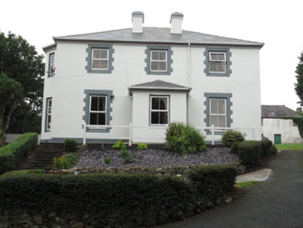
Ballagh HouseHouse · 17 mi

Explorer Tom Ballagh House in Roundstone is showing off its shutters to every passing boat, ignoring any nosy neighbours on the…
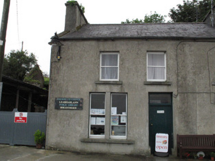
Leabharlann Cloch na RónHouse · 17 mi

Explorer Tom Leabharlann Cloch na Rón is sick of people asking if the name means ‘Rock of the Seals’ or something equally boring.…

Saint Mary's Church (Moyrus)Church/chapel · 17 mi

Explorer Tom Saint Mary's Church in Roundstone is stuck in a feud over who owns the best view of the village. The rubble stone…

Alexander NimmoMemorial · 17 mi

Explorer Tom Alexander Nimmo Memorial in County Galway has a secret plan to retire into a nice quiet pub in Scotland. He’s been…

Ivy HouseHouse · 17 mi

Explorer Tom Ivy House in Roundstone would use a lotto win to buy a very expensive pair of curtains. It has kept its timber sash…

Séipéal Realt na Mara [Catholic Church of Our Lady Star of the Sea]Church/chapel · 17 mi

Explorer Tom Séipéal Realt na Mara is in a full-blown feud with the rain because it keeps getting its stained-glass windows wet…

More archaeology and monuments in County Galway · All of County Galway

Add to this placeAdd a picture Add a detailed tip Add a story

Explore the map1,095,414 places to discover

Next place · or swipeHigh Island