What is recorded here
The people at the house in Gragadder might have called everyone in to help when a farm job grew bigger than expected. One would bring the wrong tool, another would give directions, and the quiet one would have it finished before they agreed on a plan.
Shown as a 'Farmhouse' on Noble and Keenan's 1752 map of County Kildare but marked as 'Castle Ruins' on Taylor's 1783 map of the county. A building possibly representing the monument is indicated but not named on the 1st. ed. (1838) of the OS 6-inch map. In open pasture. When inspected in 1985 the site was found to be occupied by a modern dwelling house (SMR file).
From the National Monuments Service (Archaeological Survey of Ireland) record KD005-004
Places near here
Photo credits
- Scaramanga731, Wikimedia Commons · CC BY-SA 4.0
- National Inventory of Architectural Heritage
- Darkone ( talk · contribs ), Wikimedia Commons · CC BY-SA 2.5
- Sitomon, Wikimedia Commons · CC BY-SA 2.0
- William Murphy from Dublin, Ireland, Wikimedia Commons · CC BY-SA 2.0
- VisionsofthePast, Wikimedia Commons · CC BY-SA 4.0
- Sudo77(new), Wikimedia Commons · CC BY-SA 4.0
- C O'Flanagan, Geograph · CC BY-SA 2.0
- Ilja Klutman from Ballinakill, Ireland, Wikimedia Commons · CC BY-SA 2.0
 Chambers Bridge and 15th LockBridge · 819 yd
 water pump1.0 mi
 Mass was there in Penal TimesMemorial · 1.1 miCastleCastle, unclassified · 1.7 miOscoil Na hÉirean Má NuadMemorial · 2.2 mi
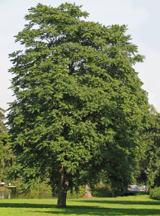 Tree of Heaven2.5 mi
 European Yew2.5 mi
 Maynooth CastleHeritage attraction · 2.5 mi
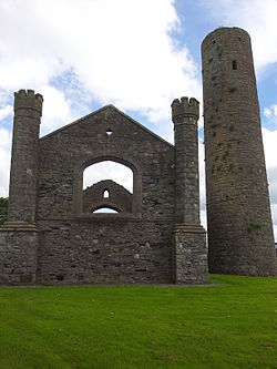 IndicatedEcclesiastical site · 2.8 mi
 Round Tower2.9 mi
 Moygaddy Tower HouseRuins · 3.1 mi
 Conolly's FollyHeritage attraction · 4.1 mi
More historic places in County Kildare · All of County Kildare
What do you know about this place?Tap to add a comment or ask a question