What is recorded here
From the National Monuments Service (Archaeological Survey of Ireland) record MO008-023
Places near here
Picture notes
- National Inventory of Architectural Heritage
- Computer-made picture. It does not show this playground.
- Computer-made picture. It does not show this garden.
- Kenneth Allen, Geograph · CC BY-SA 2.0
- Enda O Flaherty, Wikimedia Commons · CC BY-SA 2.0
- Raymond Okonski, Wikimedia Commons · CC BY-SA 2.0
- Brian Lenehan, Geograph · CC BY-SA 2.0
- Alvesgaspar, Wikimedia Commons · CC BY-SA 3.0
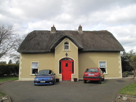 Corrinshigo CottageHouse · 731 yd
Explorer Tom Corrinshigo Cottage has caught my eye in Corrinshigo, County Monaghan. I bet a house with a name like that could keep me talking all afternoon; I'm already inventing a daft little scene for it, and I'll stop before it turns into history.
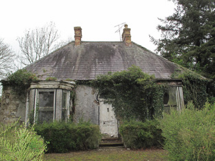 Mullahara CottageHouse · 1283 yd
Explorer Tom Mullahara Cottage has caught my eye in Tirnamona, County Monaghan. I bet a house with a name like that could keep me talking all afternoon; I'm already inventing a daft little scene for it, and I'll stop before it turns into history.
 Rough HillMountain / peak · 1728 yd
Explorer Tom Rough Hill has caught my eye in County Monaghan. I bet a mountain / peak with a name like that could keep me talking all afternoon; I'm already inventing a daft little scene for it, and I'll stop before it turns into history.
 Children's playground1.7 miComputer-made picture. It does not show this playground.
Explorer Tom Children's playground has caught my eye in County Monaghan. I bet a children's playground with a name like that could keep me talking all afternoon; I'm already inventing a daft little scene for it, and I'll stop before it turns into history.
Hazel WoodWood · 2.7 miExplorer Tom Hazel Wood has caught my eye in County Monaghan. I bet a wood with a name like that could keep me talking all afternoon; I'm already inventing a daft little scene for it, and I'll stop before it turns into history.
Jaundice WellSpring · 3.8 miExplorer Tom Jaundice Well has caught my eye in County Monaghan. I bet a spring with a name like that could keep me talking all afternoon; I'm already inventing a daft little scene for it, and I'll stop before it turns into history.
 The Walled GardenGarden · 3.9 miComputer-made picture. It does not show this garden.
Explorer Tom The Walled Garden has caught my eye in County Monaghan. I bet a garden with a name like that could keep me talking all afternoon; I'm already inventing a daft little scene for it, and I'll stop before it turns into history.
 Sliabh Beagh Hotel and Tourism CentreVisitor information · 4.5 mi
Explorer Tom Sliabh Beagh Hotel and Tourism Centre has caught my eye in County Monaghan. I bet a visitor information with a name like that could keep me talking all afternoon; I'm already inventing a daft little scene for it, and I'll stop before it turns into history.
 Giants GreveWedge tomb · 4.8 mi
Explorer Tom Giants Greve has caught my eye in Calliagh, County Monaghan. I bet a wedge tomb with a name like that could keep me talking all afternoon; I'm already inventing a daft little scene for it, and I'll stop before it turns into history.
 Rossmore MonumentMemorial · 4.8 mi
Explorer Tom Rossmore Monument has caught my eye in County Monaghan. I bet a memorial with a name like that could keep me talking all afternoon; I'm already inventing a daft little scene for it, and I'll stop before it turns into history.
 Old Cross SquareMonument · 4.9 mi
Explorer Tom Old Cross Square has caught my eye in County Monaghan. I bet a monument with a name like that could keep me talking all afternoon; I'm already inventing a daft little scene for it, and I'll stop before it turns into history.
 Common Lime5.9 mi
Explorer Tom Common Lime has caught my eye in County Monaghan. I bet a common lime with a name like that could keep me talking all afternoon; I'm already inventing a daft little scene for it, and I'll stop before it turns into history.
More archaeology and monuments in County Monaghan · All of County Monaghan
What do you know about this place?Tap to add a comment or ask a question